Conteville | |
|---|---|
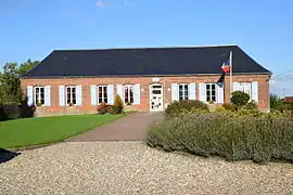 The town hall in Conteville | |
Location of Conteville | |
 Conteville  Conteville | |
| Coordinates: 49°41′42″N 1°38′06″E / 49.695°N 1.635°E | |
| Country | France |
| Region | Normandy |
| Department | Seine-Maritime |
| Arrondissement | Dieppe |
| Canton | Gournay-en-Bray |
| Intercommunality | CC Aumale - Blangy-sur-Bresle |
| Government | |
| • Mayor (2020–2026) | Jean-Pierre Courtois[1] |
| Area 1 | 13.71 km2 (5.29 sq mi) |
| Population | 500 |
| • Density | 36/km2 (94/sq mi) |
| Time zone | UTC+01:00 (CET) |
| • Summer (DST) | UTC+02:00 (CEST) |
| INSEE/Postal code | 76186 /76390 |
| Elevation | 193–247 m (633–810 ft) (avg. 248 m or 814 ft) |
| 1 French Land Register data, which excludes lakes, ponds, glaciers > 1 km2 (0.386 sq mi or 247 acres) and river estuaries. | |
Conteville (French pronunciation: [kɔ̃tvil] ⓘ) is a commune in the Seine-Maritime department in the Normandy region in northern France.
Geography
A farming village situated in the Pays de Bray, some 36 miles (58 km) southeast of Dieppe, at the junction of the D9 and the D36 roads.
Population
| Year | Pop. | ±% p.a. |
|---|---|---|
| 1968 | 504 | — |
| 1975 | 447 | −1.70% |
| 1982 | 401 | −1.54% |
| 1990 | 460 | +1.73% |
| 1999 | 454 | −0.15% |
| 2007 | 472 | +0.49% |
| 2012 | 544 | +2.88% |
| 2017 | 491 | −2.03% |
| Source: INSEE[3] | ||
Places of interest
- The church of St.Nicolas, dating from the eighteenth century.
See also
References
- ↑ "Répertoire national des élus: les maires". data.gouv.fr, Plateforme ouverte des données publiques françaises (in French). 2 December 2020.
- ↑ "Populations légales 2021". The National Institute of Statistics and Economic Studies. 28 December 2023.
- ↑ Population en historique depuis 1968, INSEE
Wikimedia Commons has media related to Conteville (Seine-Maritime).
This article is issued from Wikipedia. The text is licensed under Creative Commons - Attribution - Sharealike. Additional terms may apply for the media files.