| Ferguson Queensland | |||||||||||||||
|---|---|---|---|---|---|---|---|---|---|---|---|---|---|---|---|
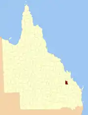 Location within Queensland | |||||||||||||||
| |||||||||||||||
The County of Ferguson is a county (a cadastral division) in Queensland, Australia, located in the Shire of Banana in Central Queensland.[1] The county is divided into civil parishes. The county was officially named and bounded by the Governor in Council on 7 March 1901 under the Land Act 1897.[2][3]
Parishes
Ferguson is divided into parishes, as listed below:
| Parish | LGA | Coordinates | Towns |
|---|---|---|---|
| Banana | Banana | 24°30′S 150°07′E / 24.500°S 150.117°E | Banana |
| Barfield | Banana | 24°34′S 150°15′E / 24.567°S 150.250°E | Tarramba |
| Benleith | Banana | 24°11′S 149°54′E / 24.183°S 149.900°E | Baralaba |
| Capayan | Banana | 24°28′S 149°56′E / 24.467°S 149.933°E | |
| Cottenham | Banana | 24°22′S 150°08′E / 24.367°S 150.133°E | |
| Fairview | Banana | 24°20′S 149°55′E / 24.333°S 149.917°E | |
| Granville | Banana | 24°10′S 150°03′E / 24.167°S 150.050°E | Kokotungo |
| Moura | Banana | 24°36′S 150°00′E / 24.600°S 150.000°E | Moura |
| Neimen | Banana | 24°28′S 150°15′E / 24.467°S 150.250°E | |
| Olinda | Banana | 24°02′S 149°54′E / 24.033°S 149.900°E | |
| Woolein | Banana | 24°11′S 150°10′E / 24.183°S 150.167°E | Rannes |
References
- ↑ Queensland showing counties / compiled and published at the Survey Department, Brisbane, Brisbane : Survey Dept., 1900.
- ↑ "Ferguson (entry 12279)". Queensland Place Names. Queensland Government. Retrieved 8 September 2015.
- ↑ Leichhardt District, County of Ferguson Maps - H1 Series at Queensland Archives.
24°28′S 150°08′E / 24.467°S 150.133°E
This article is issued from Wikipedia. The text is licensed under Creative Commons - Attribution - Sharealike. Additional terms may apply for the media files.