Crowley, Oregon | |
|---|---|
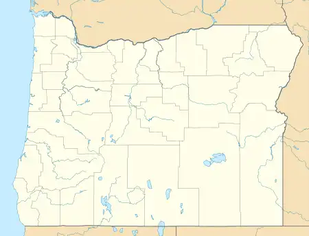 Crowley, Oregon Location within the state of Oregon  Crowley, Oregon Crowley, Oregon (the United States) | |
| Coordinates: 43°17′30″N 117°53′40″W / 43.29167°N 117.89444°W | |
| Country | United States |
| State | Oregon |
| County | Malheur |
| Elevation | 4,078 ft (1,243 m) |
| Time zone | UTC−07:00 (Mountain) |
| • Summer (DST) | UTC−06:00 (Mountain) |
| Area code | 541 |
| GNIS feature ID | 1119587[1] |
| Coordinates and elevation from Geographic Names Information System[1] | |
Crowley is an unincorporated community in Malheur County, Oregon, United States.[1] It lies along Crowley Road, north of Oregon Route 78, about 50 miles (80 km) east of Crane.[2] Crowley Ranch and Crowley Ranch Airstrip are nearby.[2]

Crowley Creek was named for Green Berry Crowley who settled on its banks with his son James in 1874.[3] The Crowleys' home was burned in 1878 during the Bannock War but the family escaped.[3] Crowley post office was established in 1911 and ran until 1935.[3] There was previously a Crowley post office in Polk County.[3]
References
- 1 2 3 "Crowley". Geographic Names Information System. United States Geological Survey. November 28, 1980. Retrieved February 1, 2017.
- 1 2 Oregon Atlas & Gazetteer (7th ed.). Yarmouth, Maine: DeLorme. 2008. p. 83. ISBN 0-89933-347-8.
- 1 2 3 4 McArthur, Lewis A.; McArthur, Lewis L. (2003) [1928]. Oregon Geographic Names (7th ed.). Portland, Oregon: Oregon Historical Society Press. p. 256. ISBN 978-0875952772.
Municipalities and communities of Malheur County, Oregon, United States | ||
|---|---|---|
| Cities | 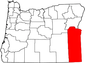 Malheur County map | |
| CDPs | ||
| Other communities | ||
| Ghost town | ||
| Indian reservation | ||
| Footnotes | ‡This populated place also has portions in an adjacent county or counties | |
This article is issued from Wikipedia. The text is licensed under Creative Commons - Attribution - Sharealike. Additional terms may apply for the media files.