Cursdorf | |
|---|---|
 Coat of arms | |
Location of Cursdorf within Saalfeld-Rudolstadt district  | |
 Cursdorf 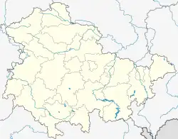 Cursdorf | |
| Coordinates: 50°34′N 11°8′E / 50.567°N 11.133°E | |
| Country | Germany |
| State | Thuringia |
| District | Saalfeld-Rudolstadt |
| Municipal assoc. | Schwarzatal |
| Government | |
| • Mayor (2022–28) | Frank Eilhauer[1] |
| Area | |
| • Total | 13.95 km2 (5.39 sq mi) |
| Elevation | 690 m (2,260 ft) |
| Population (2022-12-31)[2] | |
| • Total | 596 |
| • Density | 43/km2 (110/sq mi) |
| Time zone | UTC+01:00 (CET) |
| • Summer (DST) | UTC+02:00 (CEST) |
| Postal codes | 98744 |
| Dialling codes | 036705 |
| Vehicle registration | SLF |
| Website | www.cursdorf.com |
Cursdorf is a municipality in the district Saalfeld-Rudolstadt, in Thuringia, Germany.
References
- ↑ Gewählte Bürgermeister - aktuelle Landesübersicht, Freistaat Thüringen, accessed 10 November 2022.
- ↑ "Bevölkerung der Gemeinden, erfüllenden Gemeinden und Verwaltungsgemeinschaften in Thüringen Gebietsstand: 31.12.2022" (in German). Thüringer Landesamt für Statistik. June 2023.
Towns and municipalities in Saalfeld-Rudolstadt | ||
|---|---|---|
Coat of arms | ||
This article is issued from Wikipedia. The text is licensed under Creative Commons - Attribution - Sharealike. Additional terms may apply for the media files.