Dalton, Kansas | |
|---|---|
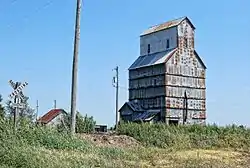 Grain Elevator in Dalton (2009) | |
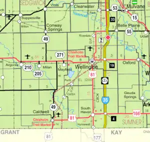 KDOT map of Sumner County (legend) | |
 Dalton  Dalton | |
| Coordinates: 37°16′9″N 97°16′21″W / 37.26917°N 97.27250°W[1] | |
| Country | United States |
| State | Kansas |
| County | Sumner |
| Elevation | 1,207 ft (368 m) |
| Time zone | UTC-6 (CST) |
| • Summer (DST) | UTC-5 (CDT) |
| Area code | 620 |
| FIPS code | 20-16950 |
| GNIS ID | 484503 [1] |
Dalton is an unincorporated community in Avon Township, Sumner County, Kansas, United States.[1] It is located about half way between Wellington and Oxford at the intersection of S Oliver Rd and E 15th St S, next to an abandoned railroad.
History
Dalton was a station on the Atchison, Topeka and Santa Fe Railway that previously passed through the community, east to west, from Oxford to Wellington.[2]
A post office was opened in Dalton in 1885, and remained in operation until it was discontinued in 1939.[3]
Education
The community is served by Oxford USD 358 public school district.
References
- 1 2 3 4 "Dalton, Kansas", Geographic Names Information System, United States Geological Survey, United States Department of the Interior
- ↑ Blackmar, Frank Wilson (1912). Kansas: A Cyclopedia of State History, Embracing Events, Institutions, Industries, Counties, Cities, Towns, Prominent Persons, Etc. Standard Publishing Company. p. 491. ISBN 9780722249055.
- ↑ "Kansas Post Offices, 1828-1961". Kansas Historical Society. Archived from the original on October 9, 2013. Retrieved June 27, 2014.
Further reading
External links
- Sumner County map, KDOT
Municipalities and communities of Sumner County, Kansas, United States | ||
|---|---|---|
| Cities | 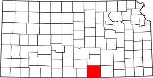 Map of Kansas highlighting Sumner County | |
| Unincorporated communities | ||
| Ghost towns | ||
| Footnotes | †This community is designated a Census-Designated Place (CDP) by the United States Census Bureau. ‡This community also has portions in an adjacent county or counties. | |
This article is issued from Wikipedia. The text is licensed under Creative Commons - Attribution - Sharealike. Additional terms may apply for the media files.