Dogtown, Mississippi | |
|---|---|
Ghost town | |
 | |
 Dogtown  Dogtown | |
| Coordinates: 34°15′53″N 89°17′09″W / 34.26472°N 89.28583°W | |
| Country | United States |
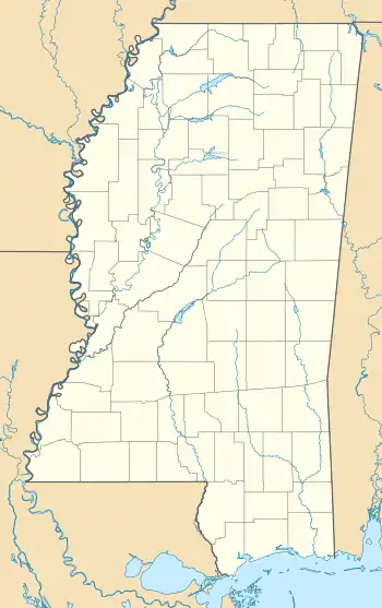
| State | Mississippi |
| County | Lafayette |
| Elevation | 423 ft (129 m) |
| Time zone | UTC-6 (Central (CST)) |
| • Summer (DST) | UTC-5 (CDT) |
| Area code | 662 |
| GNIS feature ID | 693095[1] |
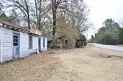
Dogtown is a ghost town in Lafayette County, Mississippi, United States, located on Highway 334, 17.6 miles (28.3 km) southeast of Oxford. At one time it was the location of Dogtown School.[2]
All that remains of Dogtown is the abandoned White's Grocery.[3]
References
- ↑ "Dogtown". Geographic Names Information System. United States Geological Survey, United States Department of the Interior.
- ↑ "Dogtown School (historical)". Geographic Names Information System. United States Geological Survey, United States Department of the Interior.
- ↑ "The Places I Live: Mississippi". Betty Press. Retrieved October 11, 2016.
Municipalities and communities of Lafayette County, Mississippi, United States | ||
|---|---|---|
| City | 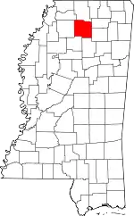 Map of Mississippi highlighting Lafayette County | |
| Towns | ||
| CDPs | ||
| Other communities | ||
| Ghost town | ||
This article is issued from Wikipedia. The text is licensed under Creative Commons - Attribution - Sharealike. Additional terms may apply for the media files.