| Donaldson Creek Tributary to Mayo Creek | |
|---|---|
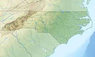 Location of Mayo Creek mouth  Donaldson Creek (Mayo Creek tributary) (the United States) | |
| Location | |
| Country | United States |
| State | North Carolina |
| County | Person |
| Physical characteristics | |
| Source | Crooked Creek divide |
| • location | pond about 2 miles southeast of Triple Springs, North Carolina |
| • coordinates | 36°27′16″N 078°49′54″W / 36.45444°N 78.83167°W[1] |
| • elevation | 625 ft (191 m)[2] |
| Mouth | Mayo Creek |
• location | about 2 miles southwest of Triple Springs, North Carolina |
• coordinates | 36°27′25″N 078°52′36″W / 36.45694°N 78.87667°W[1] |
• elevation | 402 ft (123 m)[3] |
| Length | 4.14 mi (6.66 km)[4] |
| Basin size | 5.38 square miles (13.9 km2)[5] |
| Discharge | |
| • location | Mayo Creek |
| • average | 6.87 cu ft/s (0.195 m3/s) at mouth with Mayo Creek[5] |
| Basin features | |
| Progression | Mayo Creek → Hyco River → Dan River → Roanoke River → Albemarle Sound |
| River system | Roanoke River |
| Tributaries | |
| • left | unnamed tributaties |
| • right | unnamed tributaries |
| Bridges | Lawson Chapel Church Road (x2) |
Donaldson Creek is a 4.14 mi (6.66 km) long 2nd order tributary to Mayo Creek in Person County, North Carolina.
Course
Donaldson Creek rises in a pond about 2 miles southeast of Triple Springs, North Carolina, and then flows northwest to join Mayo Creek about 2 miles southwest of Triple Springs.[3]
Watershed
Donaldson Creek drains 5.38 square miles (13.9 km2) of area, receives about 46.4 in/year of precipitation, has a wetness index of 402.03, and is about 63% forested.[5]
References
- 1 2 "GNIS Detail - Donaldson Creek". geonames.usgs.gov. US Geological Survey. Retrieved 27 May 2021.
- ↑ "Get Maps". USGS Topoview. US Geological Survey. Retrieved 27 May 2021.
- 1 2 "Get Maps". USGS Topoview. US Geological Survey. Retrieved 27 May 2021.
- ↑ "ArcGIS Web Application". epa.maps.arcgis.com. US EPA. Retrieved 27 May 2021.
- 1 2 3 "Donaldson Creek Watershed Report". US EPA Geoviewer. US EPA. Retrieved 27 May 2021.
This article is issued from Wikipedia. The text is licensed under Creative Commons - Attribution - Sharealike. Additional terms may apply for the media files.