| Eden Peak | |
|---|---|
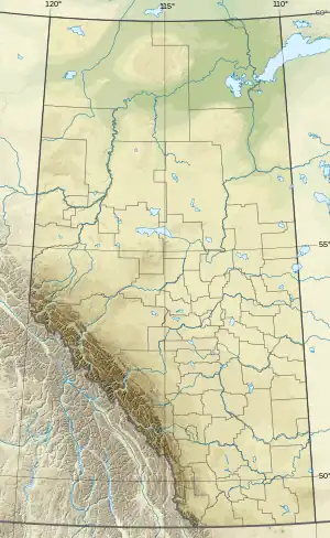 Eden Peak Location in Alberta and British Columbia 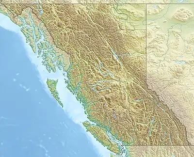 Eden Peak Eden Peak (British Columbia) | |
| Highest point | |
| Elevation | 3,180 m (10,430 ft)[1][2] |
| Prominence | 267 m (876 ft)[3] |
| Parent peak | Apex Mountain (3250 m)[3] |
| Listing | |
| Coordinates | 52°11′16″N 117°43′57″W / 52.18778°N 117.73250°W[4] |
| Geography | |
| Country | Canada |
| Provinces | Alberta and British Columbia |
| Protected area | Jasper National Park |
| Parent range | Park Ranges |
| Topo map | NTS 83C4 Clemenceau Icefield[4] |
| Climbing | |
| First ascent | August 26, 1927 by Alfred J. Ostheimer, Hans Fuhrer, J. Weber[1][3] |
Eden Peak is located on the border of Alberta and British Columbia, east of Cummins Lakes Provincial Park and between the Chaba and Apex Glaciers.[4] It was named in 1901 by Jean Habel.[1][3]
See also
References
- 1 2 3 "Eden Peak". cdnrockiesdatabases.ca. Retrieved 2019-08-11.
- ↑ "Topographic map of Eden Peak". opentopomap.org. Retrieved 2021-08-25.
- 1 2 3 4 "Eden Peak". Bivouac.com. Retrieved 2021-08-25.
- 1 2 3 "Eden Peak". BC Geographical Names. Retrieved 2021-08-25.
This article is issued from Wikipedia. The text is licensed under Creative Commons - Attribution - Sharealike. Additional terms may apply for the media files.