| Scottish Gaelic name | Eilean Mòr |
|---|---|
| Meaning of name | Big island |
 | |
| Location | |
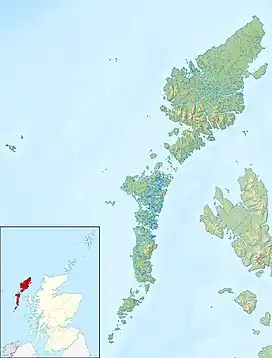 Eilean Mòr Eilean Mòr shown within the Outer Hebrides | |
| OS grid reference | NB217221 |
| Coordinates | 58°06′04″N 6°43′30″W / 58.101°N 6.725°W |
| Physical geography | |
| Island group | Lewis |
| Area | 59 hectares (150 acres) |
| Area rank | 183= (Freshwater 5) [1] |
| Highest elevation | 64 metres (210 ft) |
| Administration | |
| Sovereign state | United Kingdom |
| Country | Scotland |
| Council area | Na h-Eileanan Siar |
| Demographics | |
| Population | 0 |
| References | [2] |
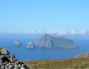
Eilean Mòr is an island in Loch Langavat on the Isle of Lewis in the Outer Hebrides of Scotland.
Footnotes
- ↑ Area and population ranks: there are c. 300 islands over 20 ha in extent and 93 permanently inhabited islands were listed in the 2011 census.
- ↑ "Get-a-Map". Ordnance Survey. Retrieved 14 September 2009.
Wikimedia Commons has media related to Eilean Mòr.
|  | ||||||||||||||||
|
| |||||||||||||||||
| |||||||||||||||||
| |||||||||||||||||
| |||||||||||||||||
| |||||||||||||||||
| |||||||||||||||||
| |||||||||||||||||
58°6′2″N 6°43′29″W / 58.10056°N 6.72472°W
This article is issued from Wikipedia. The text is licensed under Creative Commons - Attribution - Sharealike. Additional terms may apply for the media files.