Emmersdorf an der Donau | |
|---|---|
 Emmersdorf as viewed from the Danube | |
|
Flag  Coat of arms | |
 Emmersdorf an der Donau Location within Austria | |
| Coordinates: 48°14′N 15°20′E / 48.233°N 15.333°E | |
| Country | Austria |
| State | Lower Austria |
| District | Melk |
| Government | |
| • Mayor | Richard Hochratner |
| Area | |
| • Total | 29.81 km2 (11.51 sq mi) |
| Elevation | 240 m (790 ft) |
| Population (2018-01-01)[2] | |
| • Total | 1,778 |
| • Density | 60/km2 (150/sq mi) |
| Time zone | UTC+1 (CET) |
| • Summer (DST) | UTC+2 (CEST) |
| Postal code | 3644 |
| Area code | 02752 |
| Website | www.emmersdorf.at |
Emmersdorf an der Donau is a town in the district of Melk in the Austrian state of Lower Austria.
Population
| Year | Pop. | ±% |
|---|---|---|
| 1971 | 1,429 | — |
| 1981 | 1,473 | +3.1% |
| 1991 | 1,631 | +10.7% |
| 2001 | 1,706 | +4.6% |
Gallery
.JPG.webp) Parish church
Parish church Residential building
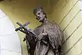 Detail of sculpture outside municipal office
Wikimedia Commons has media related to Emmersdorf an der Donau.
References
- ↑ "Dauersiedlungsraum der Gemeinden Politischen Bezirke und Bundesländer - Gebietsstand 1.1.2018". Statistics Austria. Retrieved 10 March 2019.
- ↑ "Einwohnerzahl 1.1.2018 nach Gemeinden mit Status, Gebietsstand 1.1.2018". Statistics Austria. Retrieved 9 March 2019.
This article is issued from Wikipedia. The text is licensed under Creative Commons - Attribution - Sharealike. Additional terms may apply for the media files.