Erquelinnes
| |
|---|---|
 | |
 Coat of arms | |
Location of Erquelinnes | |
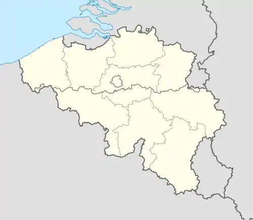 Erquelinnes Location in Belgium
Location of Erquelinnes in Hainaut  | |
| Coordinates: 50°18′N 04°07′E / 50.300°N 4.117°E | |
| Country | |
| Community | French Community |
| Region | Wallonia |
| Province | Hainaut |
| Arrondissement | Thuin |
| Government | |
| • Mayor | David Lavaux |
| • Governing party/ies | IC |
| Area | |
| • Total | 44.54 km2 (17.20 sq mi) |
| Population (2018-01-01)[1] | |
| • Total | 9,940 |
| • Density | 220/km2 (580/sq mi) |
| Postal codes | 6560 |
| NIS code | 56022 |
| Area codes | 071 |
| Website | www.erquelinnes.be |
Erquelinnes (French pronunciation: [ɛʁkəlin] ⓘ; Walloon: Erkelene) is a municipality of Wallonia located in the province of Hainaut, Belgium.
Located on the border with France, where the commune of Maubeuge lies, Erquelinnes had a total resident population of 9,549, in 2006. The total area is 44.23 km2 (17.08 sq mi) which gives a population density of 216 inhabitants per km2.
The municipality consists of the following districts: Bersillies-l'Abbaye, Erquelinnes, Grand-Reng, Hantes-Wihéries, Montignies-Saint-Christophe, and Solre-sur-Sambre.

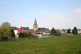
Saint George's church
Heritage
References
- ↑ "Wettelijke Bevolking per gemeente op 1 januari 2018". Statbel. Retrieved 9 March 2019.
External links
 Media related to Erquelinnes at Wikimedia Commons
Places adjacent to Erquelinnes | |
|---|---|
| Ath | 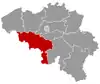 | |
|---|---|---|
| Charleroi | ||
| La Louvière | ||
| Mons | ||
| Soignies | ||
| Thuin | ||
| Tournai-Mouscron | ||
| ||
This article is issued from Wikipedia. The text is licensed under Creative Commons - Attribution - Sharealike. Additional terms may apply for the media files.