Ethel, Arkansas | |
|---|---|
 Ethel, Arkansas  Ethel, Arkansas | |
| Coordinates: 34°17′11″N 91°09′49″W / 34.28639°N 91.16361°W | |
| Country | United States |
| State | Arkansas |
| County | Arkansas |
| Elevation | 177 ft (54 m) |
| Time zone | UTC-6 (Central (CST)) |
| • Summer (DST) | UTC-5 (CDT) |
| ZIP code | 72048 |
| Area code | 870 |
| GNIS feature ID | 48920[1] |
Ethel is an unincorporated community in Arkansas County, Arkansas, United States. Ethel is located on Arkansas Highway 17, 10 miles (16 km) east of DeWitt. Ethel has a post office with ZIP code 72048.[2]
Education
Residents are in the DeWitt School District.[3][4] It operates DeWitt High School.
References
- ↑ U.S. Geological Survey Geographic Names Information System: Ethel, Arkansas
- ↑ ZIP Code Lookup
- ↑ "SCHOOL DISTRICT REFERENCE MAP (2010 CENSUS): Arkansas County, AR." U.S. Census Bureau. Retrieved on May 24, 2018.
- ↑ "General Highway Map Arkansas County, Arkansas" (PDF). Arkansas Department of Transportation. Archived from the original (PDF) on October 2, 2018. Retrieved February 25, 2021. - See Ethel on the map.
Municipalities and communities of Arkansas County, Arkansas, United States | ||
|---|---|---|
| Cities | 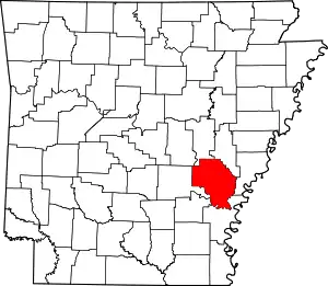 Map of Arkansas highlighting Arkansas County | |
| Towns | ||
| Other communities | ||
| Footnotes | ‡This populated place also has portions in an adjacent county or counties | |
This article is issued from Wikipedia. The text is licensed under Creative Commons - Attribution - Sharealike. Additional terms may apply for the media files.