Fléac-sur-Seugne | |
|---|---|
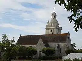 The church in Fléac-sur-Seugne | |
Location of Fléac-sur-Seugne | |
 Fléac-sur-Seugne  Fléac-sur-Seugne | |
| Coordinates: 45°32′06″N 0°32′17″W / 45.535°N 0.5381°W | |
| Country | France |
| Region | Nouvelle-Aquitaine |
| Department | Charente-Maritime |
| Arrondissement | Jonzac |
| Canton | Pons |
| Intercommunality | Haute-Saintonge |
| Government | |
| • Mayor (2020–2026) | Daniel Frédéric[1] |
| Area 1 | 8.28 km2 (3.20 sq mi) |
| Population | 361 |
| • Density | 44/km2 (110/sq mi) |
| Time zone | UTC+01:00 (CET) |
| • Summer (DST) | UTC+02:00 (CEST) |
| INSEE/Postal code | 17159 /17800 |
| Elevation | 11–56 m (36–184 ft) |
| 1 French Land Register data, which excludes lakes, ponds, glaciers > 1 km2 (0.386 sq mi or 247 acres) and river estuaries. | |
Fléac-sur-Seugne (French pronunciation: [fleak syʁ sœɲ], literally Fléac on Seugne) is a commune in the Charente-Maritime department in southwestern France.
Geography
The Seugne forms all of the commune's western border.
Population
| Year | Pop. | ±% p.a. |
|---|---|---|
| 1968 | 356 | — |
| 1975 | 310 | −1.96% |
| 1982 | 295 | −0.71% |
| 1990 | 340 | +1.79% |
| 1999 | 319 | −0.71% |
| 2009 | 366 | +1.38% |
| 2014 | 376 | +0.54% |
| 2020 | 361 | −0.68% |
| Source: INSEE[3] | ||
See also
References
- ↑ "Répertoire national des élus: les maires". data.gouv.fr, Plateforme ouverte des données publiques françaises (in French). 2 December 2020.
- ↑ "Populations légales 2021". The National Institute of Statistics and Economic Studies. 28 December 2023.
- ↑ Population en historique depuis 1968, INSEE
External links
 Media related to Fléac-sur-Seugne at Wikimedia Commons
This article is issued from Wikipedia. The text is licensed under Creative Commons - Attribution - Sharealike. Additional terms may apply for the media files.