Fox Township | |
|---|---|
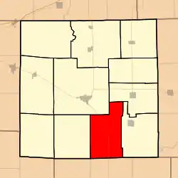 Location in Jasper County | |
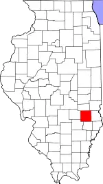 Jasper County's location in Illinois | |
| Coordinates: 38°54′35″N 88°06′01″W / 38.90972°N 88.10028°W | |
| Country | United States |
| State | Illinois |
| County | Jasper |
| Established | Before 1901 |
| Area | |
| • Total | 40.88 sq mi (105.9 km2) |
| • Land | 40.79 sq mi (105.6 km2) |
| • Water | 0.09 sq mi (0.2 km2) 0.22% |
| Elevation | 502 ft (153 m) |
| Population (2010) | |
| • Estimate (2016)[1] | 505 |
| • Density | 12.6/sq mi (4.9/km2) |
| Time zone | UTC-6 (CST) |
| • Summer (DST) | UTC-5 (CDT) |
| ZIP codes | 62448, 62475, 62480 |
| FIPS code | 17-079-27390 |
Fox Township is one of eleven townships in Jasper County, Illinois, USA. As of the 2010 census, its population was 512 and it contained 205 housing units.[2]
Geography
According to the 2010 census, the township has a total area of 40.88 square miles (105.9 km2), of which 40.79 square miles (105.6 km2) (or 99.78%) is land and 0.09 square miles (0.23 km2) (or 0.22%) is water.[2]
Unincorporated towns
- Boos at 38°55′48″N 88°06′39″W / 38.930044°N 88.110871°W
- West Liberty at 38°51′12″N 88°05′04″W / 38.853379°N 88.084482°W
(This list is based on USGS data and may include former settlements.)
Adjacent townships
- Willow Hill Township (northeast)
- Sainte Marie Township (east)
- Preston Township, Richland County (south)
- Denver Township, Richland County (southwest)
- Smallwood Township (west)
- Wade Township (northwest)
Cemeteries
The township contains this cemetery: Bethel(Quaker)
Major highways
Demographics
| Census | Pop. | Note | %± |
|---|---|---|---|
| 2016 (est.) | 505 | [1] | |
| U.S. Decennial Census[3] | |||
School districts
- East Richland Community Unit School District 1
- Jasper County Community Unit School District 1
Political districts
- Illinois' 19th congressional district
- State House District 108
- State Senate District 54
References
- "Fox Township, Jasper County, Illinois". Geographic Names Information System. United States Geological Survey, United States Department of the Interior. Retrieved January 17, 2010.
- United States Census Bureau 2007 TIGER/Line Shapefiles
- United States National Atlas
- 1 2 "Population and Housing Unit Estimates". Retrieved June 9, 2017.
- 1 2 "Population, Housing Units, Area, and Density: 2010 - County -- County Subdivision and Place -- 2010 Census Summary File 1". United States Census. Archived from the original on February 12, 2020. Retrieved May 28, 2013.
- ↑ "Census of Population and Housing". Census.gov. Retrieved June 4, 2016.
External links
Municipalities and communities of Jasper County, Illinois, United States | ||
|---|---|---|
| Cities | Map of Illinois highlighting Jasper County | |
| Villages | ||
| Townships | ||
| CDP | ||
| Other communities | ||
This article is issued from Wikipedia. The text is licensed under Creative Commons - Attribution - Sharealike. Additional terms may apply for the media files.