Frankenblick | |
|---|---|
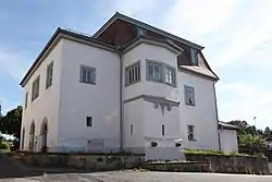 Town hall | |
 Coat of arms | |
Location of Frankenblick within Sonneberg district 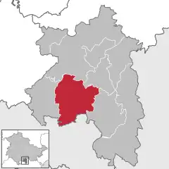 | |
 Frankenblick 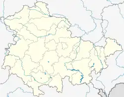 Frankenblick | |
| Coordinates: 50°22′N 11°4′E / 50.367°N 11.067°E | |
| Country | Germany |
| State | Thuringia |
| District | Sonneberg |
| Government | |
| • Mayor (2019–25) | Ute Müller-Gothe[1] (CDU) |
| Area | |
| • Total | 60.65 km2 (23.42 sq mi) |
| Elevation | 395 m (1,296 ft) |
| Population (2022-12-31)[2] | |
| • Total | 5,617 |
| • Density | 93/km2 (240/sq mi) |
| Time zone | UTC+01:00 (CET) |
| • Summer (DST) | UTC+02:00 (CEST) |
| Postal codes | 96528 |
| Dialling codes | 03675, 036766 |
| Vehicle registration | SON, NH |
| Website | www |
Frankenblick is a municipality in the Sonneberg district of Thuringia, Germany.
Frankenblick was formed on 1 January 2012 by the merger of the former municipalities Effelder-Rauenstein and Mengersgereuth-Hämmern. Today, it consists of the districts Effelder, Rauenstein, Grümpen, Seltendorf, Rabenäußig, Rückerswind, Meschenbach, Döhlau and Mengersgereuth-Hämmern.[3]
Gallery
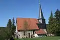 Effelder church
.jpg.webp) Rauenstein ruin
Rauenstein ruin Fritz Müller (centre), chairman of the Landwirtschaftliche Produktionsgenossenschaft Seltendorf with MTS-Brigadier Georg Stenzel (left) and agricultural engineer Karl Reichenbacher, August 1958.
References
- ↑ Gewählte Bürgermeister - aktuelle Landesübersicht, Freistaat Thüringen, accessed 14 July 2021.
- ↑ "Bevölkerung der Gemeinden, erfüllenden Gemeinden und Verwaltungsgemeinschaften in Thüringen Gebietsstand: 31.12.2022" (in German). Thüringer Landesamt für Statistik. June 2023.
- ↑ "Frankenblick" (in German). Tourismusverband Franken e.V. Retrieved 18 October 2018.
Wikimedia Commons has media related to Frankenblick.
Towns and municipalities in Sonneberg (district) | ||
|---|---|---|
This article is issued from Wikipedia. The text is licensed under Creative Commons - Attribution - Sharealike. Additional terms may apply for the media files.