Gays Creek, Kentucky | |
|---|---|
 Gays Creek, Kentucky | |
| Coordinates: 37°19′41″N 83°25′40″W / 37.32806°N 83.42778°W | |
| Country | United States |
| State | Kentucky |
| County | Perry |
| Elevation | 886 ft (270 m) |
| Time zone | UTC-5 (Eastern (EST)) |
| • Summer (DST) | UTC-4 (EDT) |
| ZIP code | 41745 |
| Area code | 606 |
| GNIS feature ID | 512293[1] |
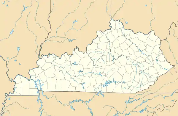
Gays Creek is an unincorporated community in Perry County, Kentucky, United States. Gays Creek is 14 miles (23 km) west-northwest of Hazard.[2] Gays Creek has a post office, established in 1888, with ZIP code 41745.[3]
The community was named in honor of Henry Gay, a local Revolutionary War veteran who died in 1830.[4]
References
- ↑ "Gays Creek". Geographic Names Information System. United States Geological Survey, United States Department of the Interior.
- ↑ State Primary Road System: Perry County (PDF) (Map). Kentucky Transportation Cabinet. 2012. Retrieved June 11, 2012.
- ↑ United States Postal Service (2012). "USPS - Look Up a ZIP Code". Retrieved February 15, 2012.
- ↑ Rennick, Robert M. (1987). Kentucky Place Names. University Press of Kentucky. p. 114. ISBN 9780813126319.
Municipalities and communities of Perry County, Kentucky, United States | ||
|---|---|---|
| Cities | 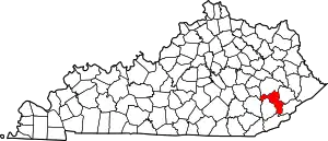 Location of Perry County, Kentucky | |
| CDPs | ||
| Other unincorporated communities |
| |
| Ghost town | ||
| Former mining towns | ||
| Post offices (and the creeks they are on) |
| |
This article is issued from Wikipedia. The text is licensed under Creative Commons - Attribution - Sharealike. Additional terms may apply for the media files.