Gogodala Rural LLG | |
|---|---|
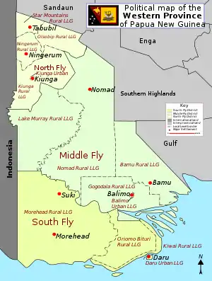 District map of Western Province | |
| Country | Papua New Guinea |
| Province | Western Province |
| Time zone | UTC+10 (AEST) |
Gogodala Rural LLG is a local-level government (LLG) of Western Province, Papua New Guinea.[1][2] The Gogodala-Suki languages, Dibiyaso, and Turumsa are mostly spoken within this LLG.[3]
Wards
- 01. Ali
- 02. Makapa (Turumsa language and Dibiyaso language speakers)
- 03. Isago
- 04. Pikiwa (Dibiyaso language speakers)
- 05. Wasapea (Kamula language speakers)
- 06. Pisi
- 07. Semabo
- 08. Awaba
- 09. Dadi
- 10. Aketa
- 11. Kawito Station
- 12. Kotale
- 13. Kewa
- 14. Tai
- 15. Dogona
- 16. Adiba
- 17. Yau
- 18. Ike
- 19. Kini
- 20. Waligi
- 21. Kimama
- 22. Bamutsa (Dibiyaso language speakers)
- 23. Uladu
- 24. Ugu
- 25. Kenewa
- 26. Waya
- 27. Kubu
- 28. Duaba
- 29. Konedobu
- 30. Pagona
- 31. Dede
- 32. Sialoa
- 33. Kawiyapo
- 34. Uric
- 35. Aduru (Makayam language speakers)
- 36. Baramula (Baramu language speakers)
- 37. Tapila (Abom language and Baramu language speakers)
- 38. Lewada (Abom language and Makayam language speakers)
- 39. Dewara (Abom language and Were language speakers)
References
- ↑ "Census Figures by Wards - Southern Region". www.nso.gov.pg. 2011 National Population and Housing Census: Ward Population Profile. Port Moresby: National Statistical Office, Papua New Guinea. 2014.
- ↑ "Final Figures". www.nso.gov.pg. 2011 National Population and Housing Census: Ward Population Profile. Port Moresby: National Statistical Office, Papua New Guinea. 2014. Archived from the original on 2015-09-06. Retrieved 2019-06-03.
- ↑ Eberhard, David M.; Simons, Gary F.; Fennig, Charles D., eds. (2019). "Papua New Guinea languages". Ethnologue: Languages of the World (22nd ed.). Dallas: SIL International.
- OCHA FISS (2018). "Papua New Guinea administrative level 0, 1, 2, and 3 population statistics and gazetteer". Humanitarian Data Exchange. 1.31.9.
- United Nations in Papua New Guinea (2018). "Papua New Guinea Village Coordinates Lookup". Humanitarian Data Exchange. 1.31.9.
This article is issued from Wikipedia. The text is licensed under Creative Commons - Attribution - Sharealike. Additional terms may apply for the media files.