| Griesgundkopf | |
|---|---|
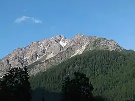 | |
| Highest point | |
| Elevation | 2,164 m (7,100 ft) |
| Prominence | 36 m (118 ft) |
| Isolation | 0.2 km (0.12 mi) |
| Geography | |
| Location | Bavaria, Germany |
References
- ↑ Groth, Heinz; Seibert, Dieter (1988). Allgäuer Alpen: Gebietsführer für Wanderer und Bergsteiger (in German). Bergverlag Rother GmbH. p. 218. ISBN 978-3-7633-3647-0.
47°19′24″N 10°14′19″E / 47.32333°N 10.23861°E
This article is issued from Wikipedia. The text is licensed under Creative Commons - Attribution - Sharealike. Additional terms may apply for the media files.