| Grog Run Tributary to Buffalo Creek | |
|---|---|
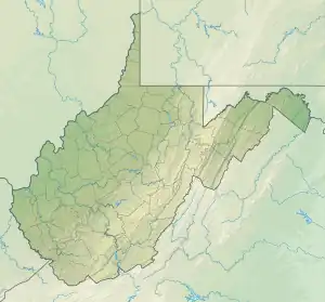 Location of Grog Run mouth  Grog Run (Buffalo Creek tributary) (the United States) | |
| Location | |
| Country | United States |
| State | West Virginia |
| County | Brooke |
| Physical characteristics | |
| Source | unnamed tributary to Ohio River divide |
| • location | about 1.5 miles east of Power, West Virginia |
| • coordinates | 40°12′42″N 080°38′04″W / 40.21167°N 80.63444°W[1] |
| • elevation | 1,090 ft (330 m)[2] |
| Mouth | Buffalo Creek |
• location | about 2 miles northwest of Bethany, West Virginia |
• coordinates | 40°13′30″N 080°35′32″W / 40.22500°N 80.59222°W[1] |
• elevation | 738 ft (225 m)[3] |
| Length | 2.53 mi (4.07 km)[4] |
| Basin size | 2.29 square miles (5.9 km2)[5] |
| Discharge | |
| • location | Buffalo Creek |
| • average | 2.71 cu ft/s (0.077 m3/s) at mouth with Buffalo Creek[5] |
| Basin features | |
| Progression | Buffalo Creek → Ohio River → Mississippi River → Gulf of Mexico |
| River system | Ohio River |
| Tributaries | |
| • left | unnamed tributaties |
| • right | unnamed tributaries |
| Bridges | none |
Grog Run is a 2.53 mi (4.07 km) long 1st order tributary to Buffalo Creek in Brooke County, West Virginia.
Course
Grog Run rises about 1.5 miles east of Power, West Virginia, and then flows west-northwest to join Buffalo Creek about 2 miles northwest of Bethany.[3]
Watershed
Grog Run drains 2.29 square miles (5.9 km2) of area, receives about 40.0 in/year of precipitation, has a wetness index of 300.19, and is about 83% forested.[5]
See also
References
- 1 2 "GNIS Detail - Grog Run". geonames.usgs.gov. US Geological Survey. Retrieved 29 May 2021.
- ↑ "Get Maps". USGS Topoview. US Geological Survey. Retrieved 29 May 2021.
- 1 2 "Get Maps". USGS Topoview. US Geological Survey. Retrieved 29 May 2021.
- ↑ "ArcGIS Web Application". epa.maps.arcgis.com. US EPA. Retrieved 29 May 2021.
- 1 2 3 "Grog Run Watershed Report". US EPA Geoviewer. US EPA. Retrieved 29 May 2021.
This article is issued from Wikipedia. The text is licensed under Creative Commons - Attribution - Sharealike. Additional terms may apply for the media files.