Grub a.Forst | |
|---|---|
 Protestant church | |
 Coat of arms | |
Location of Grub a.Forst within Coburg district  | |
 Grub a.Forst 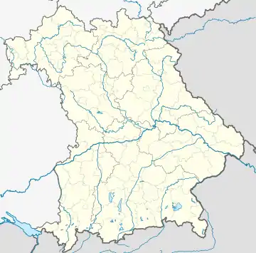 Grub a.Forst | |
| Coordinates: 50°13′N 11°1′E / 50.217°N 11.017°E | |
| Country | Germany |
| State | Bavaria |
| Admin. region | Oberfranken |
| District | Coburg |
| Municipal assoc. | Grub am Forst |
| Subdivisions | 6 Ortsteile |
| Government | |
| • Mayor (2020–26) | Jürgen Wittmann[1] |
| Area | |
| • Total | 11.97 km2 (4.62 sq mi) |
| Elevation | 300 m (1,000 ft) |
| Population (2022-12-31)[2] | |
| • Total | 2,806 |
| • Density | 230/km2 (610/sq mi) |
| Time zone | UTC+01:00 (CET) |
| • Summer (DST) | UTC+02:00 (CEST) |
| Postal codes | 96271 |
| Dialling codes | 09560 |
| Vehicle registration | CO |
| Website | www.grub-am-forst.de |
Grub am Forst is a municipality in the district of Coburg in Bavaria in Germany. It has ca 3,100 residents. The nearest large town is Coburg. The following villages are part of it:
- Buscheller
- Forsthub
- Rohrbach
- Roth am Forst
- Zeickhorn
The municipality's political parties are the CSU, SPD, the Freie Wähler and the Wählervereinigung Gut für Grub.
The coat of arms shows a pinophyta in a valley between two hills. It describes the location of Grub am Forst: a village between two hills (Grub/Grube) which is located near to a forest (Forst/Wald).
References
- ↑ Liste der ersten Bürgermeister/Oberbürgermeister in kreisangehörigen Gemeinden, Bayerisches Landesamt für Statistik, 15 July 2021.
- ↑ Genesis Online-Datenbank des Bayerischen Landesamtes für Statistik Tabelle 12411-003r Fortschreibung des Bevölkerungsstandes: Gemeinden, Stichtag (Einwohnerzahlen auf Grundlage des Zensus 2011)
External links
Towns and municipalities in Coburg (district) | ||
|---|---|---|
Coat of Arms of Coburg district | ||
This article is issued from Wikipedia. The text is licensed under Creative Commons - Attribution - Sharealike. Additional terms may apply for the media files.