Györe | |
|---|---|
Village | |
_2021_01.jpg.webp) The former Lutheran church converted into a primary school | |
 Coat of arms | |
 Györe | |
| Coordinates: 46°17′39″N 18°23′47″E / 46.29417°N 18.39639°E | |
| Country | |
| Region | Southern Transdanubia |
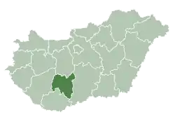
| County | Tolna |
| District | Bonyhád |
| Area | |
| • Total | 11.32 km2 (4.37 sq mi) |
| Population (2022)[1] | |
| • Total | 579 |
| • Density | 51/km2 (130/sq mi) |
| Time zone | UTC+1 (CET) |
| • Summer (DST) | UTC+2 (CEST) |
| Postal code | 7352 |
| Area code | 74 |
| KSH code | 25539[1] |
| Website | www |
Györe is a village in Tolna County, Hungary.
References
- 1 2 3 "Györe". Detailed Gazetteer of Hungary. Hungarian Central Statistical Office. Retrieved 2024-01-15.
| Towns (2) |
| |
|---|---|---|
| Villages (23) | ||
| City with county rights |
|   |
|---|---|---|
| Towns | ||
| Large villages | ||
| Villages |
| |
| Other topics |
| |
This article is issued from Wikipedia. The text is licensed under Creative Commons - Attribution - Sharealike. Additional terms may apply for the media files.