Hörbich | |
|---|---|
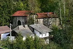 Tannberg castle | |
 Coat of arms | |
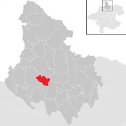 Location in the district | |
 Hörbich Location within Austria | |
| Coordinates: 48°31′06″N 13°54′54″E / 48.51833°N 13.91500°E | |
| Country | Austria |
| State | Upper Austria |
| District | Rohrbach |
| Government | |
| • Mayor | Johann Ecker (ÖVP) |
| Area | |
| • Total | 11.21 km2 (4.33 sq mi) |
| Elevation | 570 m (1,870 ft) |
| Population (2018-01-01)[2] | |
| • Total | 420 |
| • Density | 37/km2 (97/sq mi) |
| Time zone | UTC+1 (CET) |
| • Summer (DST) | UTC+2 (CEST) |
| Postal code | 4132 |
| Area code | 07286 |
| Vehicle registration | RO |
Hörbich is a municipality in the district of Rohrbach in the Austrian state of Upper Austria.
Population
| Year | Pop. | ±% |
|---|---|---|
| 1869 | 546 | — |
| 1880 | 564 | +3.3% |
| 1890 | 548 | −2.8% |
| 1900 | 513 | −6.4% |
| 1910 | 483 | −5.8% |
| 1923 | 482 | −0.2% |
| 1934 | 471 | −2.3% |
| 1939 | 448 | −4.9% |
| 1951 | 454 | +1.3% |
| 1961 | 431 | −5.1% |
| 1971 | 473 | +9.7% |
| 1981 | 450 | −4.9% |
| 1991 | 428 | −4.9% |
| 2001 | 400 | −6.5% |
| 2011 | 416 | +4.0% |
| 2017 | 429 | +3.1% |
References
- ↑ "Dauersiedlungsraum der Gemeinden Politischen Bezirke und Bundesländer - Gebietsstand 1.1.2018". Statistics Austria. Retrieved 10 March 2019.
- ↑ "Einwohnerzahl 1.1.2018 nach Gemeinden mit Status, Gebietsstand 1.1.2018". Statistics Austria. Retrieved 9 March 2019.
Wikimedia Commons has media related to Hörbich.
This article is issued from Wikipedia. The text is licensed under Creative Commons - Attribution - Sharealike. Additional terms may apply for the media files.