| Hall Run Tributary to Youghiogheny River | |
|---|---|
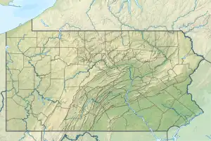 Location of Hall Run mouth  Hall Run (Youghiogheny River tributary) (the United States) | |
| Location | |
| Country | United States |
| State | Pennsylvania |
| County | Fayette |
| Physical characteristics | |
| Source | Fike Run divide |
| • location | Fiketown, Pennsylvania[1] |
| • coordinates | 39°43′40″N 079°27′07″W / 39.72778°N 79.45194°W[2] |
| • elevation | 2,310 ft (700 m)[1] |
| Mouth | Youghiogheny River in Youghiogheny River Lake |
• location | Somerfield, Pennsylvania[3] |
• coordinates | 39°45′00″N 079°24′48″W / 39.75000°N 79.41333°W[2] |
• elevation | 1,439 ft (439 m)[3] |
| Length | 7.68 mi (12.36 km)[4] |
| Basin size | 12.15 square miles (31.5 km2)[5] |
| Discharge | |
| • location | Youghiogheny River in Youghiogheny River Lake |
| • average | 24.13 cu ft/s (0.683 m3/s) at mouth with Youghiogheny River[5] |
| Basin features | |
| Progression | Youghiogheny River → Monongahela River → Ohio River → Mississippi River → Gulf of Mexico |
| River system | Monongahela River |
| Tributaries | |
| • left | Pinkham Run |
| • right | unnamed tributaries |
| Bridges | Glass Road, PA 281, US 40, PA 281, Forrest Road, Dark Hollow Road, Myers Drive |
Hall Run is a 7.68 mi (12.36 km) long 3rd order tributary to the Youghiogheny River in Fayette County, Pennsylvania.
Variant names
According to the Geographic Names Information System, it has also been known historically as:[2]
- Hall's Run
- Halls Run
Course
Hall Run rises at Fiketown, Pennsylvania,[1] and then flows easterly to join the Youghiogheny River in Youghiogheny River Lake at Somerfield.[3]
Watershed
Hall Run drains 12.15 square miles (31.5 km2) of area, receives about 48.3 in/year of precipitation, has a wetness index of 350.05, and is about 72% forested.[5]
See also
References
- 1 2 3 "Get Maps". USGS Topoview. US Geological Survey. Retrieved 26 November 2020.
- 1 2 3 "GNIS Detail - Hall Run". geonames.usgs.gov. US Geological Survey. Retrieved 26 November 2020.
- 1 2 3 "Get Maps". USGS Topoview. US Geological Survey. Retrieved 26 November 2020.
- ↑ "ArcGIS Web Application". epa.maps.arcgis.com. US EPA. Retrieved 26 November 2020.
- 1 2 3 "Hall Run Watershed Report". US EPA Geoviewer. US EPA. Retrieved 26 November 2020.
This article is issued from Wikipedia. The text is licensed under Creative Commons - Attribution - Sharealike. Additional terms may apply for the media files.