Hasselø Plantage | |
|---|---|
Town | |
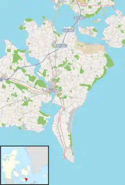 Hasselø Plantage Location on Falster | |
| Coordinates: 54°44′24″N 11°52′41″E / 54.74000°N 11.87806°E | |
| Country | Denmark |
| Region | Zealand (Sjælland) |
| Municipality | Guldborgsund |
| Population (2023) | |
| • Total | 225 |
| Time zone | UTC+1 (CET) |
| • Summer (DST) | UTC+2 (CEST) |
Hasselø Plantage is a coastal village located 4 kilometres (2.5 mi) south of Nykøbing on the Danish island of Falster. As of 2023, it has a population of 225.[1]
History
Hasselø was once an island but since dikes were built in 1873 it has been a part of Falster. Around 1600, on the initiative of Queen Sophie, the wife of King Frederick II, a colony of Dutchmen was established on Hasselø to supply Nykøbing Palace with vegetables.[2] During the Second World War, the Germans operated a radar station and surveillance facilities in Hasselø.[3]
References
- ↑ BY3: Population 1. January, by urban areas: The Mobile Statbank from Statistics Denmark
- ↑ "Hasselø", Den Store Danske. (in Danish) Retrieved 20 November 2012.
- ↑ "Hasselø", Spionage-lfm. (in Danish) Retrieved 20 November 2012.
This article is issued from Wikipedia. The text is licensed under Creative Commons - Attribution - Sharealike. Additional terms may apply for the media files.