| Hattah Victoria | |||||||||||||||
|---|---|---|---|---|---|---|---|---|---|---|---|---|---|---|---|
 Hattah | |||||||||||||||
| Coordinates | 34°46′01″S 142°16′59″E / 34.767°S 142.283°E | ||||||||||||||
| Population | 28 (2016 census)[1] | ||||||||||||||
| Postcode(s) | 3501 | ||||||||||||||
| Location | |||||||||||||||
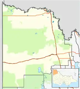
| LGA(s) | Rural City of Mildura | ||||||||||||||
| Region | Sunraysia | ||||||||||||||
| State electorate(s) | Mildura | ||||||||||||||
| Federal division(s) | Mallee | ||||||||||||||
| |||||||||||||||
Hattah is a locality in Victoria, Australia located approximately 70 km south of Mildura. Located adjacent to Hattah is the Hattah-Kulkyne National Park.
Hattah had a Post Office for some months in 1903. Later when the railway arrived a Post Office again opened on 15 January 1915 known as Hattah R.S.(for Railway Station) until 1923. This office closed in 1974.[3]
Hattah is about 10 kilometres (6.2 mi) east of the southern part of the Raak Boinka.[4]
References
- ↑ Australian Bureau of Statistics (27 June 2017). "Hattah (State Suburb)". 2016 Census QuickStats. Retrieved 1 September 2020.
- ↑ "Travelmate". Archived from the original on 1 May 2001. Retrieved 31 May 2008.
- ↑ Phoenix Auctions History, Post Office List, retrieved 13 February 2021
- ↑ Macumber, Phillip G. (1991), Interactions between groundwater and surface systems in northern Victoria., Department of Conservation and Environment, State of Victoria, p. 261, ISBN 0724197168, retrieved 4 June 2018
Localities in the Rural City of Mildura | ||
|---|---|---|
| City | | |
| Town | ||
| Locality | ||
^ - Territory divided with another LGA | ||
This article is issued from Wikipedia. The text is licensed under Creative Commons - Attribution - Sharealike. Additional terms may apply for the media files.