| Havre Seamount | |
|---|---|
 Satellite image of 2012 eruption | |
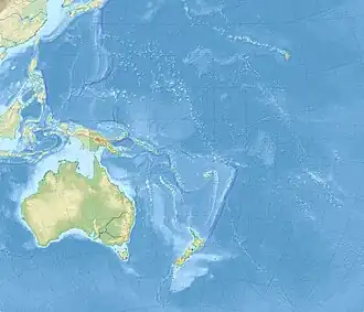
 Location of Havre Seamount in Oceania | |
| Summit depth | 720 m (2,400 ft) |
| Height | 1,030 m (3,400 ft) |
| Location | |
| Location | South Pacific Ocean |
| Group | Kermadec Islands |
| Coordinates | 31°07′S 179°00′W / 31.11°S 179.00°W |
| Country | New Zealand |
| Geology | |
| Type | Seamount |
| Last eruption | July 2012 |
Havre Seamount is an active volcanic seamount lying within the Kermadec Islands group of New Zealand, in the south-west Pacific Ocean, on the Tonga-Kermadec Ridge.[1] Its most recent eruption took place in July 2012.[2]
See also
References
- ↑ Knafelc, J.; Gust, D.; Bryan, S. E.; Anderson, M.; Cathey, H. E. (2022). "Petrogenesis of Havre Volcano in the Kermadec Arc: 2012 Eruption of a Chemically Homogeneous Rhyolite". Frontiers in Earth Science. 10. Bibcode:2022FrEaS..10.6897K. doi:10.3389/feart.2022.886897.
As most volcanoes in the Kermadec rear-arc are inactive, Havre and Giggenbach are both classified as active rear arc volcanoes
- ↑ "Havre Seamount". Global Volcanism Program. Smithsonian Institution. Retrieved 28 June 2021.
This article is issued from Wikipedia. The text is licensed under Creative Commons - Attribution - Sharealike. Additional terms may apply for the media files.