Heugraben | |
|---|---|
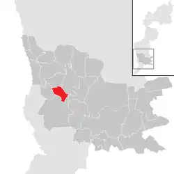 Location within Güssing district | |
 Heugraben Location within Austria | |
| Coordinates: 47°7′N 16°11′E / 47.117°N 16.183°E | |
| Country | Austria |
| State | Burgenland |
| District | Güssing |
| Government | |
| • Mayor | Walter Zloklikovits (SPÖ) |
| Area | |
| • Total | 6.47 km2 (2.50 sq mi) |
| Population (2018-01-01)[2] | |
| • Total | 216 |
| • Density | 33/km2 (86/sq mi) |
| Time zone | UTC+1 (CET) |
| • Summer (DST) | UTC+2 (CEST) |
| Postal code | 7551 |
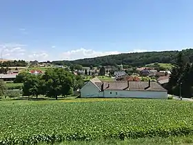
Heugraben is a town in the district of Güssing in the Austrian state of Burgenland.
Population
| Year | Pop. | ±% |
|---|---|---|
| 1869 | 443 | — |
| 1880 | 441 | −0.5% |
| 1890 | 531 | +20.4% |
| 1900 | 488 | −8.1% |
| 1910 | 487 | −0.2% |
| 1923 | 481 | −1.2% |
| 1934 | 421 | −12.5% |
| 1939 | 386 | −8.3% |
| 1951 | 367 | −4.9% |
| 1961 | 281 | −23.4% |
| 1971 | 275 | −2.1% |
| 1981 | 261 | −5.1% |
| 1991 | 251 | −3.8% |
| 2001 | 250 | −0.4% |
| 2011 | 229 | −8.4% |
| 2021 | 227 | −0.9% |
References
- ↑ "Dauersiedlungsraum der Gemeinden Politischen Bezirke und Bundesländer - Gebietsstand 1.1.2018". Statistics Austria. Retrieved 10 March 2019.
- ↑ "Einwohnerzahl 1.1.2018 nach Gemeinden mit Status, Gebietsstand 1.1.2018". Statistics Austria. Retrieved 9 March 2019.
This article is issued from Wikipedia. The text is licensed under Creative Commons - Attribution - Sharealike. Additional terms may apply for the media files.