Hilger, Montana | |
|---|---|
| Country | United States |
| State | Montana |
| County | Fergus |
| Area | |
| • Total | 0.28 sq mi (0.73 km2) |
| • Land | 0.28 sq mi (0.73 km2) |
| • Water | 0.00 sq mi (0.00 km2) |
| Population (2020) | |
| • Total | 24 |
| • Density | 85.71/sq mi (33.04/km2) |
| FIPS code | 30-36325 |
| GNIS feature ID | 772408[2] |
Hilger is an unincorporated community and census-designated place in Fergus County, Montana, United States. The community is located along U.S. Highway 191 in central Fergus County. Hilger has a post office with the ZIP code 59451.[3] It is 15 miles north of Lewistown.
Demographics
| Census | Pop. | Note | %± |
|---|---|---|---|
| 2020 | 24 | — | |
| U.S. Decennial Census[4] | |||
History
A post office has been in operation in Hilger since 1911.[5] The community was named for settler and historian David J. Hilger.[6]
In 1911 the Chicago, Milwaukee, St. Paul and Pacific Railroad, known as the Milwaukee Road, was built in Hilger.[7]
References
- ↑ "ArcGIS REST Services Directory". United States Census Bureau. Retrieved September 18, 2022.
- ↑ U.S. Geological Survey Geographic Names Information System: Hilger, Montana
- ↑ USPS – Cities by ZIP Code
- ↑ "Census of Population and Housing". Census.gov. Retrieved June 4, 2016.
- ↑ U.S. Geological Survey Geographic Names Information System: Hilger Post Office
- ↑ "Origins of Names on Milwaukee". Roundup Record-Tribune & Winnett Times. August 22, 1940. p. 6. Retrieved April 27, 2015.
- ↑ "Hilger". Montana Place Names Companion. Montana Historical Society. Retrieved April 5, 2021.
External links
- U.S. Geological Survey Geographic Names Information System: Hilger, Montana
- Hilger – Russell Country Montana
Municipalities and communities of Fergus County, Montana, United States | ||
|---|---|---|
| City | 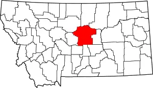 Fergus County map | |
| Towns | ||
| CDPs | ||
| Other communities | ||
| Ghost town | ||
| Indian reservation | ||
| Footnotes | ‡This populated place also has portions in an adjacent county or counties | |
47°15′14″N 109°21′36″W / 47.25389°N 109.36000°W
This article is issued from Wikipedia. The text is licensed under Creative Commons - Attribution - Sharealike. Additional terms may apply for the media files.