Hohes Kreuz | |
|---|---|
 Coat of arms | |
Location of Hohes Kreuz | |
 Hohes Kreuz 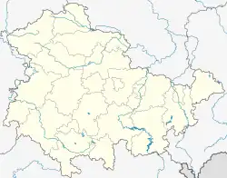 Hohes Kreuz | |
| Coordinates: 51°25′31″N 10°5′36″E / 51.42528°N 10.09333°E | |
| Country | Germany |
| State | Thuringia |
| District | Eichsfeld |
| Town | Heilbad Heiligenstadt |
| Area | |
| • Total | 17.96 km2 (6.93 sq mi) |
| Elevation | 347 m (1,138 ft) |
| Population (2022-12-31) | |
| • Total | 1,303 |
| • Density | 73/km2 (190/sq mi) |
| Time zone | UTC+01:00 (CET) |
| • Summer (DST) | UTC+02:00 (CEST) |
| Postal codes | 37308 |
| Dialling codes | 03606 |
Hohes Kreuz (German pronunciation: [ˈhoːəs ˈkʁɔʏts]) is a former municipality in the Eichsfeld in Thuringia, Germany. The municipality was created in 1991 by merging the municipalities of Bischhagen, Mengelrode, Siemerode, and Streitholz. On 1 January 2024 it became part of the town Heilbad Heiligenstadt.[1]
References
- ↑ Thüringer Gesetz zur freiwilligen Neugliederung kreisangehöriger Gemeinden im Jahr 2024, Gesetz- und Verordnungsblatt für den Freistaat Thüringen, 2023 Nr. 15, p. 348
This article is issued from Wikipedia. The text is licensed under Creative Commons - Attribution - Sharealike. Additional terms may apply for the media files.