Indian Lake, Missouri | |
|---|---|
 Indian Lake  Indian Lake | |
| Coordinates: 38°05′37″N 91°27′11″W / 38.09361°N 91.45306°W | |
| Country | United States |
| State | Missouri |
| County | Crawford |
| Townships | Knobview Benton |
| Area | |
| • Total | 1.91 sq mi (4.96 km2) |
| • Land | 1.44 sq mi (3.72 km2) |
| • Water | 0.48 sq mi (1.24 km2) |
| Elevation | 925 ft (282 m) |
| Population (2020) | |
| • Total | 689 |
| • Density | 479.81/sq mi (185.26/km2) |
| Time zone | UTC-6 (Central (CST)) |
| • Summer (DST) | UTC-5 (CDT) |
| ZIP Code | 65453 (Cuba) |
| Area code | 573 |
| FIPS code | 29-35180 |
| GNIS feature ID | 2804684[2] |
Indian Lake is an unincorporated community and census-designated place (CDP) in Crawford County, Missouri, United States. It is in the northwestern part of the county, surrounding a lake of the same name, a reservoir on Brush Creek, a north-flowing tributary of the Bourbeuse River. The community is 5 miles (8 km) northwest of Cuba and Interstate 44.
Indian Lake was first listed as a CDP prior to the 2020 census.[2]
Demographics
| Census | Pop. | Note | %± |
|---|---|---|---|
| 2020 | 689 | — | |
| U.S. Decennial Census[3] | |||
References
- ↑ "ArcGIS REST Services Directory". United States Census Bureau. Retrieved August 28, 2022.
- 1 2 3 U.S. Geological Survey Geographic Names Information System: Indian Lake, Missouri
- ↑ "Census of Population and Housing". Census.gov. Retrieved June 4, 2016.
Municipalities and communities of Crawford County, Missouri, United States | ||
|---|---|---|
| Cities | 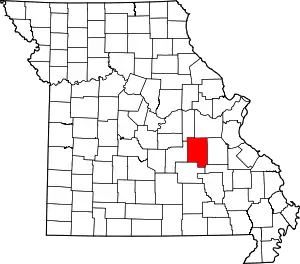 Map of Missouri highlighting Crawford County | |
| Villages | ||
| Townships | ||
| CDP | ||
| Unincorporated communities | ||
| Ghost towns | ||
| Footnotes | ‡This populated place also has portions in an adjacent county or counties | |
This article is issued from Wikipedia. The text is licensed under Creative Commons - Attribution - Sharealike. Additional terms may apply for the media files.