| Irvin Branch Tributary to Anderson Creek | |
|---|---|
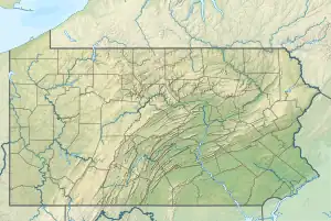 Location of Irvin Branch mouth  Irvin Branch (Anderson Creek tributary) (the United States) | |
| Location | |
| Country | United States |
| State | Pennsylvania |
| County | Clearfield |
| Physical characteristics | |
| Source | unnamed tributary to Panther Run divide |
| • location | about 5 miles north of Greenville, Pennsylvania |
| • coordinates | 41°03′18″N 078°36′11″W / 41.05500°N 78.60306°W[1] |
| • elevation | 2,150 ft (660 m)[2] |
| Mouth | |
• location | about 0.5 miles northeast of Greenville, Pennsylvania |
• coordinates | 41°01′09″N 078°35′19″W / 41.01917°N 78.58861°W[1] |
• elevation | 1,430 ft (440 m)[3] |
| Length | 2.91 mi (4.68 km)[4] |
| Basin size | 2.18 square miles (5.6 km2)[5] |
| Discharge | |
| • location | Anderson Creek |
| • average | 3.88 cu ft/s (0.110 m3/s) at mouth with Anderson Creek[5] |
| Basin features | |
| Progression | Anderson Creek → West Branch Susquehanna River → Susquehanna River → Chesapeake Bay → Atlantic Ocean |
| River system | Susquehanna River |
| Tributaries | |
| • left | unnamed tributaries |
| • right | unnamed tributaries |
| Bridges | none |
Irvin Branch is a 2.91 mi (4.68 km) long 1st order tributary to Anderson Creek in Clearfield County, Pennsylvania. Irvin Branch is classified as a coldwater fishery (CWF) and contains a population of Brook Trout. Some mining has occurred in the headwaters of the stream, but it is not considered impaired by it.[6]
Course
Irvin Branch rises about 5 miles north of Greenville, Pennsylvania, and then flows southeast to join Anderson Creek about 0.5 miles northeast of Greenville.[3]
Watershed
Irvin Branch drains 2.18 square miles (5.6 km2) of area, receives about 45.1 in/year of precipitation, has a wetness index of 377.55, and is about 97% forested.[5]
See also
References
- 1 2 "GNIS Detail - Irvin Branch". geonames.usgs.gov. US Geological Survey. Retrieved 22 August 2021.
- ↑ "Get Maps". USGS Topoview. US Geological Survey. Retrieved 22 August 2021.
- 1 2 "Get Maps". USGS Topoview. US Geological Survey. Retrieved 22 August 2021.
- ↑ "ArcGIS Web Application". epa.maps.arcgis.com. US EPA. Retrieved 22 August 2021.
- 1 2 3 "Irvin Branch Watershed Report". US EPA Geoviewer. US EPA. Retrieved 22 August 2021.
- ↑ "Anderson Creek Watershed Assessment, Restoration and Implementation Plan" (PDF). Western Pennsylvania Conservancy. Retrieved 23 August 2021.
Watershed Maps
Course and Watershed of Irvin Branch (Anderson Creek tributary) in Clearfield County, Pennsylvania, USA
This article is issued from Wikipedia. The text is licensed under Creative Commons - Attribution - Sharealike. Additional terms may apply for the media files.