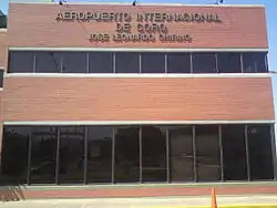
José Leonardo Chirino International Airport | |||||||||||
|---|---|---|---|---|---|---|---|---|---|---|---|
 | |||||||||||
| Summary | |||||||||||
| Airport type | Public | ||||||||||
| Location | Santa Ana de Coro, Venezuela | ||||||||||
| Elevation AMSL | 52 ft / 16 m | ||||||||||
| Coordinates | 11°24′55″N 069°40′50″W / 11.41528°N 69.68056°W | ||||||||||
| Map | |||||||||||
.svg.png.webp) CZE Location of the airport in Venezuela | |||||||||||
| Runways | |||||||||||
| |||||||||||
José Leonardo Chirino Airport (IATA: CZE, ICAO: SVCR), is an airport serving Coro, the capital of Falcón state in Venezuela. It is named to honor José Leonardo Chirino, leader of a 1795 rebellion in Coro that called for the abolition of slavery and the establishment of a democratic republic.
The runway length includes a 100 metres (330 ft) displaced threshold on Runway 27.
See also
References
- ↑ Airport information for CZE at Great Circle Mapper.
- ↑ Google Maps - Coro
- ↑ CRO VOR
External links
![]() Media related to José Leonardo Chirino Airport at Wikimedia Commons
Media related to José Leonardo Chirino Airport at Wikimedia Commons
This article is issued from Wikipedia. The text is licensed under Creative Commons - Attribution - Sharealike. Additional terms may apply for the media files.