Unterwellenborn | |
|---|---|
 Coat of arms | |
Location of Unterwellenborn within Saalfeld-Rudolstadt district 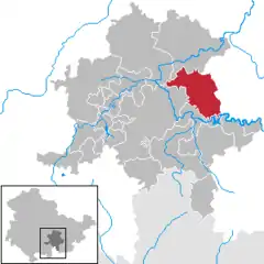 | |
 Unterwellenborn 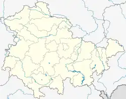 Unterwellenborn | |
| Coordinates: 50°39′31″N 11°26′31″E / 50.65861°N 11.44194°E | |
| Country | Germany |
| State | Thuringia |
| District | Saalfeld-Rudolstadt |
| Government | |
| • Mayor (2018–24) | Andrea Wende[1] |
| Area | |
| • Total | 63.06 km2 (24.35 sq mi) |
| Elevation | 265 m (869 ft) |
| Population (2022-12-31)[2] | |
| • Total | 8,426 |
| • Density | 130/km2 (350/sq mi) |
| Time zone | UTC+01:00 (CET) |
| • Summer (DST) | UTC+02:00 (CEST) |
| Postal codes | 07333, 07334, 07336, 07387 |
| Dialling codes | 03647, 03671, 036732 |
| Vehicle registration | SLF |
| Website | www.unterwellenborn.de |
Unterwellenborn is a municipality in the district Saalfeld-Rudolstadt, in Thuringia, Germany. It was created on 1 February 2006 by fusion of the municipalities Birkigt, Goßwitz, Könitz, Lausnitz bei Pößneck and Unterwellenborn itself which had cooperated earlier as Verwaltungsgemeinschaft Unterwellenborn. Already on 9 April 1994, the municipalities Dorfkulm, Langenschade and Oberwellenborn had become part of the municipality of Unterwellenborn. In July 2018 the former municipality of Kamsdorf was merged into Unterwellenborn.
References
- ↑ Gewählte Bürgermeister - aktuelle Landesübersicht, Freistaat Thüringen, accessed 14 July 2021.
- ↑ "Bevölkerung der Gemeinden, erfüllenden Gemeinden und Verwaltungsgemeinschaften in Thüringen Gebietsstand: 31.12.2022" (in German). Thüringer Landesamt für Statistik. June 2023.
Towns and municipalities in Saalfeld-Rudolstadt | ||
|---|---|---|
Coat of arms | ||
This article is issued from Wikipedia. The text is licensed under Creative Commons - Attribution - Sharealike. Additional terms may apply for the media files.