Katrovozh
Катровож | |
|---|---|
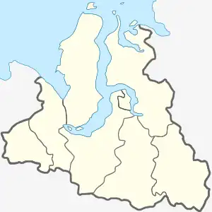 Katrovozh Location in Russia 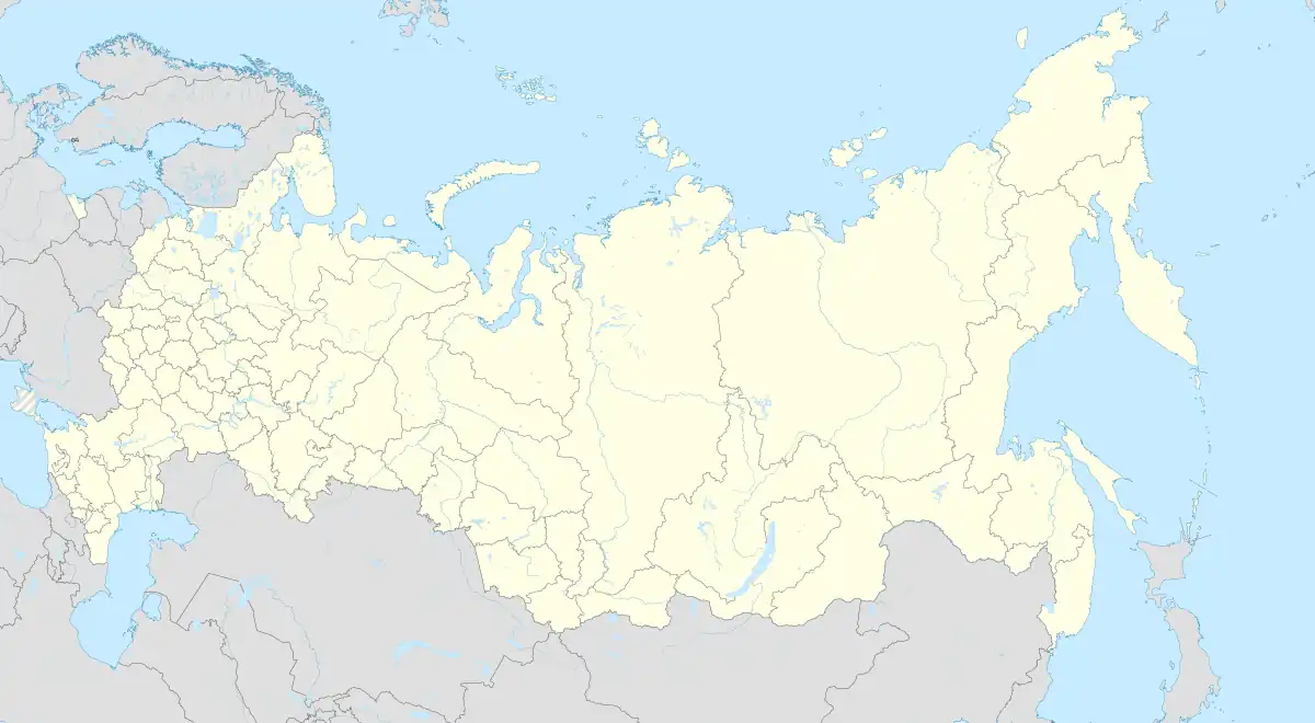 Katrovozh Katrovozh (Russia) | |
| Coordinates: 66°19′32″N 66°6′13″E / 66.32556°N 66.10361°E | |
| Country | Russia |
| Federal subject | Yamalo-Nenets Autonomous Okrug |
| District | Priuralsky |
| Area | |
| • Total | 0.413 km2 (0.159 sq mi) |
| Elevation | 22 m (72 ft) |
| Population (2019)[3] | |
| • Total | 779 |
| • Density | 1,900/km2 (4,900/sq mi) |
| Time zone | UTC+5 (YEKT) |
| Postal code | 629624 |
Katrovozh or Sobskiye (Russian: Катровож) is a village along the Ob river in Yamalo-Nenets Autonomous Okrug, Russia with a subarctic Köppen climate classification and record high temperatures of 34 °C compared to record low temperatures of -50 °C.[4][5][6] Katrovozh's population has decreased from 824 in 2002 to 779 in 2019 and its population is connected to the outside world via flights to Salekhard.[7][8][9]
References
- ↑ "Katrovozh · Yamalo-Nenets Autonomous Okrug, Russia, 629624". Katrovozh · Yamalo-Nenets Autonomous Okrug, Russia, 629624.
- ↑ "Katrovozh, Yamalo-Nenets, RU Climate Zone, Monthly Averages, Historical Weather Data". tcktcktck.org.
- ↑ "mun_obr2019 RAR file".
- ↑ "Katravozh · Yamalo-Nenets Autonomous Okrug, Russia, 629624". Katravozh · Yamalo-Nenets Autonomous Okrug, Russia, 629624. Retrieved 2022-08-24.
- ↑ "Mindat.org". www.mindat.org. Retrieved 2022-08-24.
- ↑ "Katrovozh, Yamalo-Nenets, RU Climate Zone, Monthly Averages, Historical Weather Data". tcktcktck.org. Retrieved 2022-08-24.
- ↑ "БД Этно-языковой состав населённых пунктов России". lingvarium.org. Retrieved 2022-08-24.
- ↑ "Russian 2019 census".
- ↑ "Салехард – Катравож и обратно". АО «Северречфлот» (in Russian). Retrieved 2022-08-24.
This article is issued from Wikipedia. The text is licensed under Creative Commons - Attribution - Sharealike. Additional terms may apply for the media files.