| Keiskamma River Keiskammarivier | |
|---|---|
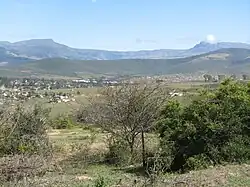 general view of Keiskammahoek where the sources of the Keiskamma River lie | |
 Location of the Keiskamma River mouth | |
| Etymology | Meaning "sweet water" in the Khoekhoe language |
| Location | |
| Country | South Africa |
| Province | Eastern Cape Province |
| Physical characteristics | |
| Source | Near Keiskammahoek |
| • location | Amatola Mountains |
| • elevation | 1,500 m (4,900 ft) |
| Mouth | Indian Ocean |
• location | Near Hamburg |
• coordinates | 33°17′0″S 27°29′20″E / 33.28333°S 27.48889°E |
• elevation | 0 m (0 ft) |
| Length | 160 km (99 mi) |
| Basin features | |
| Tributaries | |
| • right | Tyhume |
The Keiskamma River (Afrikaans: Keiskammarivier) is a river in the Eastern Cape Province in South Africa. The river flows into the Indian Ocean in the Keiskamma Estuary, located by Hamburg Nature Reserve, near Hamburg,[1] midway between East London and Port Alfred. The Keiskamma flows first in a southwestern and then in a southeastern direction after meeting its main tributary, the Tyhume River.[2]
The Keiskamma River marked the border between the Cape Province and former British Kaffraria, known also then as Queen Adelaide's Province, until 1847.[3]
Presently this river is part of the Mzimvubu to Keiskamma Water Management Area.[4]
Ecology
There is a small population of the endangered Eastern Province rocky (Sandelia bainsii) in the Tyhume River, part of the Keiskamma river basin.[5]
Dams
See also
References
External links
- Keiskamma River Catchment (South Africa)
- Towns of historical interest in the 'kei
- Cape slavery heritage
- The carcass of Huberta, the Keiskamma River Hippopotamus (Apr 1931)