Kirchheim b.München | |
|---|---|
 Saint Andrew Church | |
 Coat of arms | |
Location of Kirchheim b.München within Munich district  | |
 Kirchheim b.München 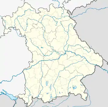 Kirchheim b.München | |
| Coordinates: 48°11′N 11°45′E / 48.183°N 11.750°E | |
| Country | Germany |
| State | Bavaria |
| Admin. region | Oberbayern |
| District | Munich |
| Government | |
| • Mayor (2020–26) | Maximilian Böltl[1] (CSU) |
| Area | |
| • Total | 15.51 km2 (5.99 sq mi) |
| Elevation | 511 m (1,677 ft) |
| Population (2022-12-31)[2] | |
| • Total | 12,714 |
| • Density | 820/km2 (2,100/sq mi) |
| Time zone | UTC+01:00 (CET) |
| • Summer (DST) | UTC+02:00 (CEST) |
| Postal codes | 85551 |
| Dialling codes | 089 |
| Vehicle registration | M |
| Website | www.kirchheim-heimstetten.de |
Kirchheim bei München is a municipality in the district of Munich, in Bavaria, Germany. It is located 14 km east of Munich (centre). As of 2020 it has a population of 12,787.
See also
- Heimstettener See
References
- ↑ Liste der ersten Bürgermeister/Oberbürgermeister in kreisangehörigen Gemeinden, Bayerisches Landesamt für Statistik, 15 July 2021.
- ↑ Genesis Online-Datenbank des Bayerischen Landesamtes für Statistik Tabelle 12411-003r Fortschreibung des Bevölkerungsstandes: Gemeinden, Stichtag (Einwohnerzahlen auf Grundlage des Zensus 2011)
This article is issued from Wikipedia. The text is licensed under Creative Commons - Attribution - Sharealike. Additional terms may apply for the media files.