Kohlberg | |
|---|---|
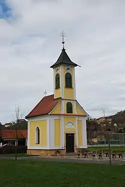 Chapel in Kohlberg | |
 Coat of arms | |
 Kohlberg Location within Austria | |
| Coordinates: 46°55′00″N 15°48′00″E / 46.91667°N 15.80000°E | |
| Country | Austria |
| State | Styria |
| District | Südoststeiermark |
| Government | |
| • Mayor | Johann Hütter (ÖVP) |
| Area | |
| • Total | 7.88 km2 (3.04 sq mi) |
| Elevation | 296 m (971 ft) |
| Population (1 January 2016)[1] | |
| • Total | 524 |
| • Density | 66/km2 (170/sq mi) |
| Time zone | UTC+1 (CET) |
| • Summer (DST) | UTC+2 (CEST) |
| Postal code | 8341, 8342 |
| Area code | +43 3151 |
| Vehicle registration | FB |
| Website | www.kohlberg. steiermark.at |
Kohlberg is a former municipality in the district of Südoststeiermark in the Austrian state of Styria. Since the 2015 Styria municipal structural reform, it is divided between the municipalities Paldau and Gnas.[2]
Population
| Year | Pop. | ±% |
|---|---|---|
| 1869 | 715 | — |
| 1880 | 751 | +5.0% |
| 1890 | 712 | −5.2% |
| 1900 | 661 | −7.2% |
| 1910 | 676 | +2.3% |
| 1923 | 684 | +1.2% |
| 1934 | 639 | −6.6% |
| 1939 | 649 | +1.6% |
| 1951 | 566 | −12.8% |
| 1961 | 547 | −3.4% |
| 1971 | 555 | +1.5% |
| 1981 | 579 | +4.3% |
| 1991 | 572 | −1.2% |
| 2001 | 554 | −3.1% |
| 2013 | 508 | −8.3% |
References
This article is issued from Wikipedia. The text is licensed under Creative Commons - Attribution - Sharealike. Additional terms may apply for the media files.