Kushoniyon District
| |
|---|---|
 | |
| Coordinates: 37°46′3″N 68°48′6″E / 37.76750°N 68.80167°E | |
| Country | |
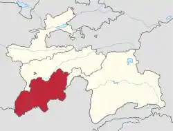
| Region | Khatlon Region |
| Capital | Ismoili Somoni |
| Area | |
| • Total | 600 km2 (200 sq mi) |
| Population (2020) | |
| • Total | 245,900 |
| • Density | 410/km2 (1,100/sq mi) |
| Time zone | UTC+5 |
| +992 3245 | 735140 |
| Official languages | |
| Website | kushoniyon |
Kushoniyon District (Russian: Район Кушониён/Кушониёнский район; Tajik: Ноҳияи Кӯшониён, before 2018: Bokhtar District)[2] is a district in Khatlon Region, Tajikistan, surrounding the regional capital Qurghonteppa (Bokhtar). Its administrative capital is the town of Ismoili Somoni (pop. 8,500).[3] The population of Kushoniyon District is 245,900 (January 2020 estimate).[4]
Administrative divisions
The district has an area of about 600 km2 (200 sq mi) and is divided administratively into three towns and five jamoats.[5] They are as follows:[6]
| Jamoat | Population (Jan. 2015)[6] |
|---|---|
| Bokhtariyon (town) | 6,700[7] |
| Bustonqala | 4,300[7] |
| Ismoili Somoni | 7,800[7] |
| Mehnatobod | 34,201 |
| Navbahor | 18,281 |
| Oriyon | 10,392 |
| Sarvati Istiqlol | 33,071 |
| Zargar | 49,235 |
History
On 7 January 1944 the district was created under the named Oktyabr District (ноҳияи Октябр) was created in the Qurghonteppa Oblast. On 6 January 1965 the District was renamed to Kommunisti District (ноҳияи Коммунистӣ). Then in 1990 the district was renamed to Bokhtar District. And finally in 2018 - to Kushoniyon District.[2]
Geology
Bokhtar area forms part of Amu Darya basin. This basin has been estimated to contain vast reserves of oil, natural gas and condensate.[8]
References
- ↑ "КОНСТИТУЦИЯ РЕСПУБЛИКИ ТАДЖИКИСТАН". prokuratura.tj. Parliament of Tajikistan. Retrieved 9 January 2020.
- 1 2 "Renaming of a number of cities, districts and settlements of Khatlon Province". 22 January 2018. Retrieved 7 October 2020.
- ↑ Republic of Tajikistan, map showing administrative division as of January 1, 2004, "Tojikkoinot" Cartographic Press, Dushanbe
- ↑ "Population of the Republic of Tajikistan as of 1 January 2020" (PDF) (in Russian). Statistics office of Tajikistan. Archived from the original (PDF) on 1 June 2021. Retrieved 7 October 2020.
- ↑ "Regions of the Republic of Tajikistan 2017" (PDF) (in Russian). Statistics office of Tajikistan. pp. 15–21. Archived from the original (PDF) on 28 March 2022. Retrieved 12 October 2020.
- 1 2 Jamoat-level basic indicators, United Nations Development Programme in Tajikistan, accessed 9 October 2020
- 1 2 3 "Population of the Republic of Tajikistan as of 1 January 2015" (PDF) (in Russian). Statistics office of Tajikistan. Archived from the original (PDF) on 2 July 2015.
- ↑ "Tethys: Tajikistan Resource Upgrade 27.5 Billion BOE". The Gazette of Central Asia. Satrapia. 19 July 2012. Retrieved 20 July 2012.
Capital: Bokhtar | |||||||||||||||||||||||||||||||||||||||||||||||
|  | ||||||||||||||||||||||||||||||||||||||||||||||
|
| |||||||||||||||||||||||||||||||||||||||||||||||
| |||||||||||||||||||||||||||||||||||||||||||||||