Lübberstedt | |
|---|---|
 Coat of arms | |
Location of Lübberstedt within Osterholz district  | |
 Lübberstedt 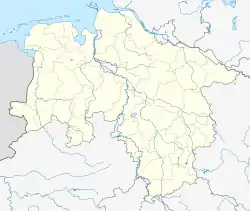 Lübberstedt | |
| Coordinates: 53°19′N 08°48′E / 53.317°N 8.800°E | |
| Country | Germany |
| State | Lower Saxony |
| District | Osterholz |
| Municipal assoc. | Hambergen |
| Government | |
| • Mayor | Dieter Langmaack (CDU) |
| Area | |
| • Total | 12.32 km2 (4.76 sq mi) |
| Elevation | 14 m (46 ft) |
| Population (2021-12-31)[1] | |
| • Total | 724 |
| • Density | 59/km2 (150/sq mi) |
| Time zone | UTC+01:00 (CET) |
| • Summer (DST) | UTC+02:00 (CEST) |
| Postal codes | 27729 |
| Dialling codes | 04793 |
| Vehicle registration | OHZ |
Lübberstedt is a village located in the district of Osterholz in the German state of Lower Saxony. It is located north of Osterholz-Scharmbeck. Together with the villages of Hambergen, Axstedt, Holste and Vollersode, it forms the Samtgemeinde of Hambergen.
History
During the last year of the war (1944) a Neuengamme sub-camp was erected near the village[2] for Jewish women from Auschwitz-Birkenau. Several female guards (Aufseherin) staffed the camp and maltreated the prisoners who were starved, overworked and brutalized.
Transport
Lübberstedt has a railway station on the Bremerhaven to Bremen line that opened in 1862. The main road is the B 74 connecting Bremen and Stade.
References
- ↑ "LSN-Online Regionaldatenbank, Tabelle A100001G: Fortschreibung des Bevölkerungsstandes, Stand 31. Dezember 2021" (in German). Landesamt für Statistik Niedersachsen.
- ↑ "Anlage zu § 1: Verzeichnis der Konzentrationslager und ihrer Außenkommandos gemäß § 42 Abs. 2 BEG" (in German). Archived from the original on 2009-04-23.
883 Lübberstedt, Kreis Wesermünde
Towns and municipalities in Osterholz | ||
|---|---|---|
Coat of arms | ||
This article is issued from Wikipedia. The text is licensed under Creative Commons - Attribution - Sharealike. Additional terms may apply for the media files.