La Chapelle-Engerbold | |
|---|---|
Part of Condé-en-Normandie | |
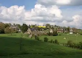 La Chapelle-Engerbold | |
Location of La Chapelle-Engerbold | |
 La Chapelle-Engerbold  La Chapelle-Engerbold | |
| Coordinates: 48°53′32″N 0°36′27″W / 48.8922°N 0.6075°W | |
| Country | France |
| Region | Normandy |
| Department | Calvados |
| Arrondissement | Vire |
| Canton | Condé-en-Normandie |
| Commune | Condé-en-Normandie |
| Area 1 | 4.07 km2 (1.57 sq mi) |
| Population (2019)[1] | 100 |
| • Density | 25/km2 (64/sq mi) |
| Time zone | UTC+01:00 (CET) |
| • Summer (DST) | UTC+02:00 (CEST) |
| Postal code | 14770 |
| Elevation | 98–206 m (322–676 ft) (avg. 50 m or 160 ft) |
| 1 French Land Register data, which excludes lakes, ponds, glaciers > 1 km2 (0.386 sq mi or 247 acres) and river estuaries. | |
La Chapelle-Engerbold (French pronunciation: [la ʃapɛl ɑ̃ʒɛʁbo][2] or [la ʃapɛl ɑ̃ʒɛʁbɔld][3]) is a former commune in the Calvados department in the Normandy region in northwestern France. On 1 January 2016, it was merged into the new commune of Condé-en-Normandie.[4]
The former commune is part of the area known as Suisse Normande.[5]
Population
| Year | Pop. | ±% |
|---|---|---|
| 1962 | 125 | — |
| 1968 | 109 | −12.8% |
| 1975 | 87 | −20.2% |
| 1982 | 93 | +6.9% |
| 1990 | 86 | −7.5% |
| 1999 | 79 | −8.1% |
| 2008 | 110 | +39.2% |
See also
References
- ↑ Téléchargement du fichier d'ensemble des populations légales en 2019, INSEE
- ↑ film "le plaisir" scène de la chapelle engerbold, retrieved 2021-08-04
- ↑ Valérie Desquesne présente sa liste pour les élections municipales de Condé-en-Normandie., retrieved 2021-08-04
- ↑ Arrêté préfectoral 1 December 2015 (in French)
- ↑ "Map of Suiss Normande" (PDF).
Wikimedia Commons has media related to La Chapelle-Engerbold.
This article is issued from Wikipedia. The text is licensed under Creative Commons - Attribution - Sharealike. Additional terms may apply for the media files.