La Rochette | |
|---|---|
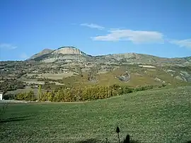 A view of La Rochette with Napoleon's Hat at 1,425 m (4,675 ft) and Puy de Manse at 1,646 m (5,400 ft) | |
.svg.png.webp) Coat of arms | |
Location of La Rochette | |
 La Rochette 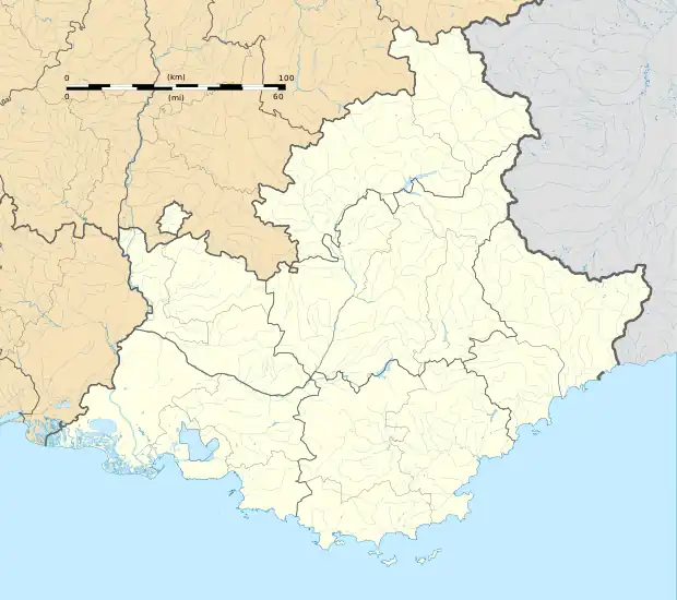 La Rochette | |
| Coordinates: 44°35′45″N 6°09′23″E / 44.5958°N 6.1564°E | |
| Country | France |
| Region | Provence-Alpes-Côte d'Azur |
| Department | Hautes-Alpes |
| Arrondissement | Gap |
| Canton | Chorges |
| Government | |
| • Mayor (2020–2026) | Marlène Durif[1] |
| Area 1 | 10.34 km2 (3.99 sq mi) |
| Population | 475 |
| • Density | 46/km2 (120/sq mi) |
| Time zone | UTC+01:00 (CET) |
| • Summer (DST) | UTC+02:00 (CEST) |
| INSEE/Postal code | 05124 /05000 |
| Elevation | 779–1,631 m (2,556–5,351 ft) (avg. 1,100 m or 3,600 ft) |
| 1 French Land Register data, which excludes lakes, ponds, glaciers > 1 km2 (0.386 sq mi or 247 acres) and river estuaries. | |
La Rochette (French pronunciation: [la ʁɔʃɛt] ⓘ; Occitan: La Rocheta) is a commune in the Hautes-Alpes department in southeastern France. It is located about 10 km north east of Gap.
Population
| Year | Pop. | ±% |
|---|---|---|
| 1962 | 276 | — |
| 1968 | 282 | +2.2% |
| 1975 | 314 | +11.3% |
| 1982 | 368 | +17.2% |
| 1990 | 397 | +7.9% |
| 1999 | 375 | −5.5% |
| 2008 | 380 | +1.3% |
See also
References
- ↑ "Répertoire national des élus: les maires". data.gouv.fr, Plateforme ouverte des données publiques françaises (in French). 2 December 2020.
- ↑ "Populations légales 2021". The National Institute of Statistics and Economic Studies. 28 December 2023.
Wikimedia Commons has media related to La Rochette, Hautes-Alpes.
This article is issued from Wikipedia. The text is licensed under Creative Commons - Attribution - Sharealike. Additional terms may apply for the media files.