Laryne
Ларине | |
|---|---|
 | |
 Laryne Location of Laryne in Donetsk Oblast 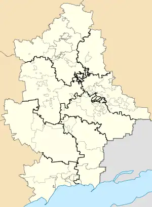 Laryne Laryne (Donetsk Oblast) | |
| Coordinates: 47°52′58″N 37°55′46″E / 47.88278°N 37.92944°E | |
| Country | |
| Oblast | |
| Raion | Donetsk Raion |
| Area | |
| • Total | 4.37 km2 (1.69 sq mi) |
| Elevation | 115 m (377 ft) |
| Population (2022)[2] | |
| • Total | 2,761 |
| • Density | 630/km2 (1,600/sq mi) |
| Time zone | UTC+2 |
| • Summer (DST) | UTC+3 |
| Postal code | 83491 |
| Area code | +380 62 |
Laryne (Ukrainian: Ларине; Russian: Ларино, romanized: Larino) is an urban-type settlement in Budonivskyi District of Donetsk municipality, Donetsk Oblast, eastern Ukraine. From 2014, it was under the control of the self-declared Donetsk People's Republic until it was annexed by Russia in 2022. Population: 2,761 (2022 estimate).[2]
References
- ↑ "Novoselivka (Donetsk Oblast)". weather.in.ua. Retrieved 17 June 2022.
- 1 2 Чисельність наявного населення України на 1 січня 2022 [Number of Present Population of Ukraine, as of January 1, 2022] (PDF) (in Ukrainian and English). Kyiv: State Statistics Service of Ukraine. Archived (PDF) from the original on 4 July 2022.
This article is issued from Wikipedia. The text is licensed under Creative Commons - Attribution - Sharealike. Additional terms may apply for the media files.