Lawrence, Utah | |
|---|---|
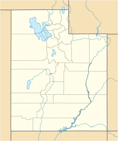 Lawrence Location in Utah  Lawrence Lawrence (the United States) | |
| Coordinates: 39°17′44″N 110°55′45″W / 39.29556°N 110.92917°W | |
| Country | United States |
| State | Utah |
| County | Emery |
| Settled | 1883 |
| Named for | Lawrence Staker |
| Elevation | 5,666 ft (1,727 m) |
| Time zone | UTC-7 (Mountain (MST)) |
| • Summer (DST) | UTC-6 (MDT) |
| ZIP code | 84528 |
| Area code | 435 |
| GNIS feature ID | 1437620[1] |
| Census | Pop. | Note | %± |
|---|---|---|---|
| 1890 | 107 | — | |
| 1900 | 160 | 49.5% | |
| 1910 | 161 | 0.6% | |
| 1920 | 139 | −13.7% | |
| 1930 | 161 | 15.8% | |
| 1940 | 169 | 5.0% | |
| 1950 | 119 | −29.6% | |
| Source: U.S. Census Bureau[2] | |||
Lawrence is an unincorporated community in northwestern Emery County, Utah, United States.
History
Lawrence was founded circa 1883 as a Mormon farming community. It formerly had its own post office and church, but the church was demolished in the 1950s. Sometimes called "Stakerville", Lawrence was named after Lawrence Staker.[3]
See also
References
- 1 2 "Lawrence". Geographic Names Information System. United States Geological Survey, United States Department of the Interior. Retrieved March 31, 2014.
- ↑ "Census of Population and Housing". U.S. Census Bureau. Archived from the original on February 8, 2006. Retrieved November 18, 2011.
- ↑ "Lawrence". GhostTowns.com. Retrieved March 31, 2014.
Municipalities and communities of Emery County, Utah, United States | ||
|---|---|---|
| Cities | 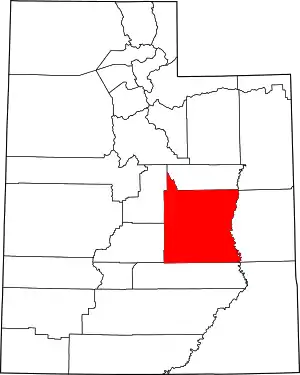 Map of Utah highlighting Emery County | |
| Towns | ||
| Unincorporated communities | ||
| Indian reservation | ||
| Ghost towns | ||
| Footnotes | ‡This populated place also has portions in an adjacent county or counties | |
This article is issued from Wikipedia. The text is licensed under Creative Commons - Attribution - Sharealike. Additional terms may apply for the media files.