Le Mesnil-Villement | |
|---|---|
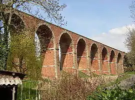 La Foullerie Viaduct | |
Location of Le Mesnil-Villement | |
 Le Mesnil-Villement  Le Mesnil-Villement | |
| Coordinates: 48°51′14″N 0°22′09″W / 48.8539°N 0.3692°W | |
| Country | France |
| Region | Normandy |
| Department | Calvados |
| Arrondissement | Caen |
| Canton | Falaise |
| Intercommunality | Pays de Falaise |
| Government | |
| • Mayor (2020–2026) | André Lecoq[1] |
| Area 1 | 3.55 km2 (1.37 sq mi) |
| Population | 286 |
| • Density | 81/km2 (210/sq mi) |
| Time zone | UTC+01:00 (CET) |
| • Summer (DST) | UTC+02:00 (CEST) |
| INSEE/Postal code | 14427 /14690 |
| Elevation | 48–187 m (157–614 ft) (avg. 75 m or 246 ft) |
| 1 French Land Register data, which excludes lakes, ponds, glaciers > 1 km2 (0.386 sq mi or 247 acres) and river estuaries. | |
Le Mesnil-Villement (French pronunciation: [lə mɛnil vilmɑ̃] ⓘ) is a commune in the Calvados department in the Normandy region in northwestern France.
The commune is part of the area known as Suisse Normande.[3]
Population
| Year | Pop. | ±% |
|---|---|---|
| 1962 | 486 | — |
| 1968 | 456 | −6.2% |
| 1975 | 416 | −8.8% |
| 1982 | 354 | −14.9% |
| 1990 | 302 | −14.7% |
| 1999 | 283 | −6.3% |
| 2008 | 292 | +3.2% |
See also
References
- ↑ "Répertoire national des élus: les maires" (in French). data.gouv.fr, Plateforme ouverte des données publiques françaises. 13 September 2022.
- ↑ "Populations légales 2021". The National Institute of Statistics and Economic Studies. 28 December 2023.
- ↑ "Map of Suiss Normande" (PDF).
Wikimedia Commons has media related to Le Mesnil-Villement.
This article is issued from Wikipedia. The text is licensed under Creative Commons - Attribution - Sharealike. Additional terms may apply for the media files.