Le Vernet | |
|---|---|
Commune | |
 | |
Location of Le Vernet | |
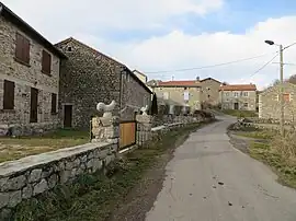
 Le Vernet  Le Vernet | |
| Coordinates: 45°02′15″N 3°40′21″E / 45.0375°N 3.6725°E | |
| Country | France |
| Region | Auvergne-Rhône-Alpes |
| Department | Haute-Loire |
| Arrondissement | Le Puy-en-Velay |
| Canton | Saint-Paulien |
| Intercommunality | CA du Puy-en-Velay |
| Government | |
| • Mayor (2020–2026) | Alain Lioutaud[1] |
| Area 1 | 3.82 km2 (1.47 sq mi) |
| Population | 22 |
| • Density | 5.8/km2 (15/sq mi) |
| Time zone | UTC+01:00 (CET) |
| • Summer (DST) | UTC+02:00 (CEST) |
| INSEE/Postal code | 43260 /43320 |
| Elevation | 1,070–1,301 m (3,510–4,268 ft) (avg. 1,120 m or 3,670 ft) |
| 1 French Land Register data, which excludes lakes, ponds, glaciers > 1 km2 (0.386 sq mi or 247 acres) and river estuaries. | |
Le Vernet (French pronunciation: [lə vɛʁnɛ]; Occitan: Lo Vernet) is a commune in the Haute-Loire department in south-central France. The Le Vernet village belongs to the district of Le Puy-en-Velay and the canton of Loudes.[3]
Population
| Year | Pop. | ±% p.a. |
|---|---|---|
| 1968 | 79 | — |
| 1975 | 67 | −2.33% |
| 1982 | 67 | +0.00% |
| 1990 | 52 | −3.12% |
| 1999 | 40 | −2.87% |
| 2009 | 36 | −1.05% |
| 2014 | 21 | −10.22% |
| 2020 | 22 | +0.78% |
| Source: INSEE[4] | ||
See also
References
- ↑ "Répertoire national des élus: les maires". data.gouv.fr, Plateforme ouverte des données publiques françaises (in French). 2 December 2020.
- ↑ "Populations légales 2021". The National Institute of Statistics and Economic Studies. 28 December 2023.
- ↑ "LE VERNET - Carte plan hotel village de Le Vernet 43320 - Cartes France.fr". www.cartesfrance.fr. Retrieved 5 December 2023.
- ↑ Population en historique depuis 1968, INSEE
Wikimedia Commons has media related to Le Vernet (Haute-Loire).
This article is issued from Wikipedia. The text is licensed under Creative Commons - Attribution - Sharealike. Additional terms may apply for the media files.