Leliefontein | |
|---|---|
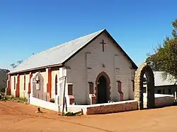 Methodist Mission Church, Leliefontein | |
 Leliefontein  Leliefontein | |
| Coordinates: 30°18′00″S 18°05′00″E / 30.3°S 18.083333°E | |
| Country | South Africa |
| Province | Northern Cape |
| District | Namakwa |
| Municipality | Kamiesberg |
| Area | |
| • Total | 0.67 km2 (0.26 sq mi) |
| Population (2011)[1] | |
| • Total | 616 |
| • Density | 920/km2 (2,400/sq mi) |
| Racial makeup (2011) | |
| • Black African | 0.3% |
| • Coloured | 99.2% |
| • Indian/Asian | 0.3% |
| • Other | 0.2% |
| First languages (2011) | |
| • Afrikaans | 95.8% |
| • English | 2.8% |
| • Tswana | 1.1% |
| • Other | 0.3% |
| Time zone | UTC+2 (SAST) |
Leliefontein is a settlement in Namakwa District Municipality in the Northern Cape province of South Africa.
A village in the Kamiesberg Mountains, 18 miles (29 km) south-east of Kamieskroon, Leliefontein was established in 1816 by Reverend Barnabas Shaw, an English Wesleyan missionary.[2][3] The mission was established on a farm awarded to the Namaquas by the Dutch governor Rijk Tulbagh.[4] It is probably named after the many white lilies found in the area.[2]
It was the site of the 1902 Leliefontein massacre, during the final stages of the Second Boer War.
From 1966 till 2016, it was the site of a major helicopter base of the SADF from where two squadrons of attack helicopters and transport helicopters operated, co-located with an Armoured Corps/Tank Battalion base and headquarters. It came under the operational responsibility of the 4th Integrated Division headquartered at Springbok.[5]
References
- 1 2 3 4 "Main Place Leliefontein". Census 2011.
- 1 2 "Leliefontein". Tracks4Africa Padkos. Retrieved 9 January 2014.
- ↑ "ancestry.com".
- ↑ Sandra Olivier (2005). Touring in South Africa. Struik. p. 169. ISBN 978-1-77007-142-1.
- ↑ "Leliefontein". Karoo Space. 21 June 2013. Retrieved 10 January 2014.
Municipalities and communities of Namakwa District Municipality, Northern Cape | ||
|---|---|---|
District seat: Springbok | ||
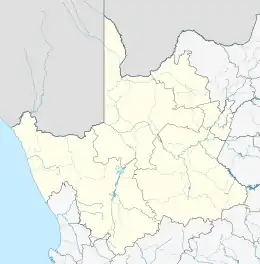
| Hantam | .svg.png.webp) Namakwa District within South Africa | |
| Kamiesberg | ||
| Karoo Hoogland | ||
| Khâi-Ma | ||
| Nama Khoi | ||
| Richtersveld | ||