Les Hogues | |
|---|---|
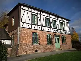 The town hall in Les Hogues | |
Location of Les Hogues | |
 Les Hogues  Les Hogues | |
| Coordinates: 49°25′38″N 1°23′50″E / 49.4272°N 1.3972°E | |
| Country | France |
| Region | Normandy |
| Department | Eure |
| Arrondissement | Les Andelys |
| Canton | Romilly-sur-Andelle |
| Government | |
| • Mayor (2020–2026) | Aline Bachelet[1] |
| Area 1 | 11.81 km2 (4.56 sq mi) |
| Population | 681 |
| • Density | 58/km2 (150/sq mi) |
| Time zone | UTC+01:00 (CET) |
| • Summer (DST) | UTC+02:00 (CEST) |
| INSEE/Postal code | 27338 /27910 |
| Elevation | 50–179 m (164–587 ft) |
| 1 French Land Register data, which excludes lakes, ponds, glaciers > 1 km2 (0.386 sq mi or 247 acres) and river estuaries. | |
Les Hogues is a commune in the Eure department in northern France.
Population
| Year | Pop. | ±% p.a. |
|---|---|---|
| 1968 | 545 | — |
| 1975 | 543 | −0.05% |
| 1982 | 503 | −1.09% |
| 1990 | 516 | +0.32% |
| 1999 | 568 | +1.07% |
| 2009 | 647 | +1.31% |
| 2014 | 632 | −0.47% |
| 2020 | 679 | +1.20% |
| Source: INSEE[3] | ||
See also
References
- ↑ "Répertoire national des élus: les maires". data.gouv.fr, Plateforme ouverte des données publiques françaises (in French). 9 August 2021.
- ↑ "Populations légales 2021". The National Institute of Statistics and Economic Studies. 28 December 2023.
- ↑ Population en historique depuis 1968, INSEE
Wikimedia Commons has media related to Les Hogues.
This article is issued from Wikipedia. The text is licensed under Creative Commons - Attribution - Sharealike. Additional terms may apply for the media files.