| United States Numbered Highways of the Arkansas Highway System | |
|---|---|
Highway markers for US 71, US 371 and US 49B | |
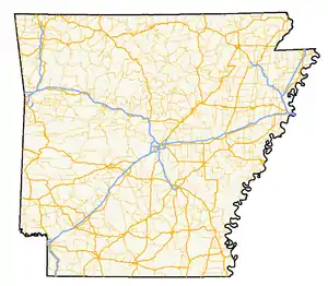 A map of highways in the state of Arkansas | |
| System information | |
| Formed | 1926 |
| Highway names | |
| US Highways | US Highway nn, US Route nn (US nn) |
| System links | |


The U.S. Highways in Arkansas are the U.S. Routes maintained by the U.S. state of Arkansas. There are 20 such highways.

1926 map of the U.S. Highways in Arkansas
Mainline highways
| Number | Length (mi) | Length (km) | Southern or western terminus | Northern or eastern terminus | Formed | Removed | Notes | |
|---|---|---|---|---|---|---|---|---|
| 182.33 | 293.43 | US 49 at Mississippi state line near Helena | US 62/ AR 1 at Piggott | 1963[1] | current | |||
| 112 | 180 | I-30 at Texarkana | US 59 at Oklahoma state line west of Acorn | 1934 | current | |||
| 75.3 | 121.2 | US 61 at Tennessee state line near West Memphis | US 61 at Missouri state line near Blytheville | 1926 | current | |||
| 329.9 | 530.9 | US 62 at Oklahoma state line | US 62 at Missouri state line near St. Francis | 1930 | current | |||
| 388 | 624 | US 167 at Junction City | US 63 at Missouri state line near Mammoth Spring | 1926 | current | |||
| 246.35 | 396.46 | US 64 at Oklahoma state line near Fort Smith | US 64 at Tennessee state line near Memphis, TN | 1926 | current | |||
| 309 | 497 | US 65 at Louisiana state line south of Eudora | US 65 at Missouri state line north of Burlington | 1926 | current | |||
| 325 | 523 | US 67 at Texas state line at Texarkana | US 67 at Missouri state line | 1926 | current | |||
| 286 | 460 | US 70 at Oklahoma state line near DeQueen | US 70 at Tennessee state line | 1926 | current | |||
| 310 | 500 | US 71 at Louisiana state line | US 71 at Missouri state line | 1926 | current | |||
| 272 | 438 | US 79 at Louisiana state line | US 79 at Tennessee state line near West Memphis | 1935 | current | |||
| 190.71 | 306.92 | US 82 at Texas state line at Texarkana | US 82 at Mississippi state line near Greenville, MS | 1931[2] | current | |||
| 183 | 295 | US 165 at Louisiana state line | US 70 at North Little Rock | 1926 | current | |||
| — | — | US 167 at Louisiana state line | US 62/US 412 in Ash Flat | 1926 | current | |||
| — | — | US 270 at Oklahoma state line | I-530/US 65 at White Hall | 1930 | current | |||
| 3 | 4.8 | US 271 at Oklahoma state line near Fort Smith | US 71B, Ft. Smith | 1926 | current | |||
| — | — | US 59/US 71 at Wickes | US 278 at Mississippi state line | 1998 | current | |||
| — | — | US 371 at Louisiana state line | US 59/US 70/US 71/ AR 41 at De Queen | 1994 | current | |||
| 290 | 470 | US 412 at Oklahoma state line near Siloam Springs | US 412 at Missouri state line | 1982 | current | |||
| 91 | 146 | US 425 at Louisiana state line | I-530/US 63/US 65/US 79 at Pine Bluff | 1989 | current | |||
Suffixed and special routes
U.S. Highways in Arkansas sometimes have spur or business routes. The signs feature a "B" if designating a business route.
| Number | Length (mi)[3] | Length (km) | Southern or western terminus | Northern or eastern terminus | Formed | Removed | Notes | |
|---|---|---|---|---|---|---|---|---|
| 3.66 | 5.89 | US 49 in Brookland | US 49 in Brookland | 2000[4] | current | |||
| 6.92 | 11.14 | US 49 in Helena-West Helena | US 49 in Helena-West Helena | 1970[5] | current | |||
| 5.2[6] | 8.4 | US 49/US 63 in Jonesboro | US 49/AR 1 in Jonesboro | 1979[7] | 1996[8] | |||
| 2.36 | 3.80 | US 49/AR 1 in Paragould | US 49/AR 1/US 412/Crowley's Ridge Parkway in Paragould | 1979[9] | current | |||
| 0.70 | 1.13 | US 412B in Paragould | US 49B in Paragould | — | — | |||
| 0.739[10] | 1.189 | Prairie Grove Battlefield State Park | US 62 in Prairie Grove | 2014[11] | current | |||
| 6 | 9.7 | US 62/US 71 in Fayetteville | US 62/US 71 in Fayetteville | 1970[12] | 1984[13] | |||
| 2.0[14] | 3.2 | US 62/AR 94 in Rogers | US 71B/AR 94 in Rogers | 1980[15] | 2010[16] | Partially renumbered AR 12 | ||
| 3.0 | 4.8 | US 62 in Eureka Springs | US 62/AR 23 in Eureka Springs | c. 1970 | 1990[17] | Former US 62C | ||
| 0.442[18] | 0.711 | US 62/US 412 in Yellville | US 62/US 412/AR 14 in Yellville | c. 1980 | current | |||
| 2.959[18][19] | 4.762 | US 62/US 412 | US 62/US 412 in Cotter | 1989[20] | current | |||
| 4.647[19] | 7.479 | US 62/US 412 in Mountain Home | US 62/US 412 in Mountain Home | 1998[21] | current | |||
| — | — | US 62/US 412 in Salem | US 62/US 412 in Salem | 1958 | current | |||
| 3.0 | 4.8 | US 62 in Eureka Springs | US 62/AR 23 in Eureka Springs | c. 1935 | c. 1970 | Renamed US 62B | ||
| 0.671[22] | 1.080 | US 62 in Berryville | A. L. Carter Street/Oak View Drive in Berryville | 1975[23] | current | |||
| 0.700[18] | 1.127 | US 62/US 412 in Pyatt | Marion CR 321 | — | — | |||
| 0.838[24] | 1.349 | US 63/AR 160 in Hermitage | US 63 in Hermitage | 2000[25] | current | Former US 63 | ||
| 2.699[24] | 4.344 | US 63/AR 8 in Warren | US 63/AR 189 in Warren | 1999[26] | current | Former AR 15B | ||
| 7.30[3] | 11.75 | I-530/US 63/US 79 in Pine Bluff | US 63/US 79/US 65B/AR 15 in Pine Bluff | 1999[26] | 2020[27] | Partially redesignated AR 463 | ||
| 0.8[28] | 1.3 | US 63 | US 70 | 1999[26] | 2008[28] | Former AR 11S | ||
| 2.4[29] | 3.9 | I-555/US 63/AR 149 in Marked Tree | I-555/US 63/AR 14/AR 75 in Marked Tree | 1970[30] | 2019[31] | Former US 63 | ||
| 1.7[32] | 2.7 | US 63 in Trumann | US 63/AR 69 in Trumann | 1959[33] | 1970[34] | |||
| 1.4[35] | 2.3 | US 63 in Jonesboro | AR 1 in Jonesboro | 1961[36] | 1970[37] | Renumbered US 63B | ||
| — | — | — | — | 1970[37] | 2006 | Former US 63C, redesignated AR 91 | ||
| 2.735[38] | 4.402 | US 63 in Bono | US 63 in Bono | 2014[39] | current | Former US 63 | ||
| 4.26[40] | 6.86 | US 63 in Walnut Ridge | US 63 | 1998[41] | current | Former US 63 | ||
| 1.517[42] | 2.441 | US 62/US 63/US 412 in Hardy | US 62/US 63/US 412 in Hardy | 2014[43] | current | Former US 63 | ||
| — | — | — | — | — | — | |||
| — | — | — | — | — | — | |||
| — | — | — | — | — | — | |||
| — | — | — | — | — | — | |||
| — | — | — | — | — | — | |||
| — | — | — | — | — | — | |||
| — | — | — | — | — | — | |||
| — | — | — | — | — | — | |||
| — | — | — | — | — | — | |||
| — | — | — | — | — | — | |||
| — | — | — | — | — | — | |||
| — | — | — | — | — | — | |||
| — | — | — | — | — | — | |||
| — | — | — | — | — | — | |||
| — | — | — | — | — | — | |||
| — | — | — | — | — | — | |||
| — | — | — | — | — | — | |||
| — | — | — | — | — | — | |||
| — | — | — | — | — | — | |||
| — | — | — | — | — | — | |||
| — | — | — | — | — | — | |||
| — | — | — | — | — | — | |||
| — | — | — | — | — | — | |||
| — | — | — | — | — | — | |||
| — | — | — | — | — | — | |||
| 1.65[3] | 2.66 | US 371 in Magnolia | US 79/US 82 in Magnolia | 1973[44] | 2019[31] | |||
| 5.425[45] | 8.731 | US 82 in El Dorado | US 82 | 1982[46] | current | |||
| 2.088[47] | 3.360 | US 82 | US 82 | 2018[48] | current | |||
| 0.128[47] | 0.206 | US 82 | Port of Crossett | — | — | |||
| 1.3 | 2.1 | US 82 in Stamps | US 82/AR 53 in Stamps | — | 2006[49] | |||
| 1.28[3] | 2.06 | US 165/AR 1 in Gillett | US 165/AR 1 in Gillett | 1982 | current | |||
| — | — | — | — | 1971[50] | current | |||
| 1.67 | 2.69 | — | — | 1968[51] | current | |||
| — | — | — | — | 2013[52] | current | |||
| — | — | — | — | — | — | |||
| — | — | — | — | — | — | |||
| 1.15 | 1.85 | US 278 in Hope | US 67 in Hope | 1990 | current | |||
| 1.88 | 3.03 | US 278 in Camden | US 79B in Camden | 1998 | current | |||
| 3.99 | 6.42 | US 278 in Warren | US 278 in Warren | 1998 | current | Former AR 4B | ||
| 8.5 | 13.7 | US 278 | US 425 | 1998 | current | Part of Future I-69 | ||
| 2.65[3] | 4.26 | US 412 | US 412/AR 45 | 2009 | current | |||
| 5.48[3] | 8.82 | US 412 | US 412 in Huntsville | 1999 | current | |||
| ||||||||
See also
References
- ↑ "Minutes of the Meeting of the Arkansas State Highway Commission" (PDF). Little Rock: Arkansas State Highway Commission. 1953–1969. pp. 903–904. OCLC 21798861. Retrieved December 5, 2020.
- ↑ Weingroff, Richard (November 18, 2015). "US 82". Highway History. Federal Highway Administration. Retrieved December 11, 2016.
- 1 2 3 4 5 6 System Information and Research Division (2014). "Arkansas Road Log Database" (MDB). Arkansas State Highway and Transportation Department. Retrieved March 27, 2016.
- ↑ "Minutes of the Meeting of the Arkansas State Highway Commission" (PDF). Little Rock: Arkansas State Highway Commission. 2000–2009. pp. 88–89. OCLC 21798861. Retrieved December 5, 2020.
- ↑ "Minutes of the Meeting of the Arkansas State Highway Commission" (PDF). Little Rock: Arkansas State Highway Commission. 1970–1979. p. 1636. OCLC 21798861. Retrieved December 5, 2020.
- ↑ Planning and Research Division (March 1990). General Highway Map Craighead County, Arkansas (PDF) (Map). 1:63500. Little Rock: Arkansas State Highway and Transportation Department. Retrieved April 6, 2011.
- ↑ Special Committee on U.S. Route Numbering (June 25, 1979). "Route Numbering Committee Agenda Showing Action Taken by the Executive Committee" (PDF) (Report). Washington, DC: American Association of State Highway and Transportation Officials. p. 1. Retrieved December 14, 2017 – via Wikimedia Commons.
- ↑ "Minutes of the Meeting of the Arkansas State Highway Commission" (PDF). Little Rock: Arkansas State Highway Commission. 1990–1999. pp. 852–853. OCLC 21798861. Retrieved December 5, 2020.
- ↑ "Minutes" (1970–1979), p. 153.
- ↑ Transportation Planning and Policy Division (February 14, 2023). State Highway Route and Section Map, Washington County, Arkansas (PDF) (Map). 1:62,500. Cartography by GIS Section. Little Rock: Arkansas Department of Transportation. Retrieved April 6, 2023.
- ↑ Special Committee on U.S. Route Numbering (November 20, 2014). "Report to SCOH" (PDF) (Report). Washington, DC: American Association of State Highway and Transportation Officials. p. 1. Archived from the original (PDF) on January 28, 2019. Retrieved December 21, 2021.
- ↑ "Minutes" (1970–1979), p. 1624
- ↑ "Minutes of the Meeting of the Arkansas State Highway Commission" (PDF). Little Rock: Arkansas State Highway Commission. 1980–1989. p. 1624. OCLC 21798861. Retrieved December 5, 2020.
- ↑ Planning Division (December 1989) [September 14, 1987]. General Highway Map, Benton County, Arkansas (PDF) (Map) (Revised ed.). 1:62,500. Little Rock: Arkansas State Highway and Transportation Department. OCLC 19750483. Retrieved February 12, 2022.
- ↑ "Minutes" (1980–1989), pp. 1007–108.
- ↑ "Minutes of the Meeting of the Arkansas State Highway Commission" (PDF). Little Rock: Arkansas State Highway Commission. 2010–2019. pp. 81–82. OCLC 21798861. Retrieved February 12, 2022.
- ↑ "Minutes" (1990–1999), p. 40.
- 1 2 3 Transportation Planning and Policy Division GIS Section (September 17, 2021). State Highway Route and Section Map, Marion County, Arkansas (PDF) (Map). 1:62,500. Little Rock: Arkansas Department of Transportation. Retrieved February 12, 2022.
- 1 2 Transportation Planning and Policy Division GIS Section (September 17, 2021). State Highway Route and Section Map, Baxter County, Arkansas (PDF) (Map). 1:62,500. Little Rock: Arkansas Department of Transportation. Retrieved February 12, 2022.
- ↑ "Minutes" (1980–1989), p. 1018.
- ↑ "Minutes" (1990–1999), p. 1181.
- ↑ Transportation Planning and Policy Division GIS Section (September 17, 2021). State Highway Route and Section Map, Carroll County, Arkansas (PDF) (Map). 1:62,500. Little Rock: Arkansas Department of Transportation. Retrieved January 15, 2022.
- ↑ "Minutes" (1970–1979), p. 788.
- 1 2 Transportation Planning and Policy Division (September 17, 2021). State Highway Route and Section Map, Bradley County, Arkansas (PDF) (Map). 1:62,500. Little Rock: Arkansas Department of Transportation. Retrieved June 2, 2022.
- ↑ "Minutes" (2000–2009), p. 10.
- 1 2 3 Special Committee on U.S. Route Numbering (October 1, 1999). "Report of the Special Committee on U.S. Route Numbering to the Standing Committee on Highways" (PDF) (Report). Washington, DC: American Association of State Highway and Transportation Officials. p. 9. Archived from the original (PDF) on October 16, 2017. Retrieved May 30, 2022.
- ↑ Special Committee on U.S. Route Numbering (November 2020). "2020 Annual (Fall) Meeting Report to the Council on Highways and Streets" (PDF) (Report). Washington, DC: American Association of State Highway and Transportation Officials. Archived from the original (PDF) on January 10, 2021. "USRN Applications" (PDF). Archived from the original (PDF) on January 10, 2021.
- 1 2 "Minutes" (2000–2009), p. 1065.
- ↑ Transportation Planning and Policy Division (March 21, 2016) [November 28, 2005]. General Highway Map, Poinsett County, Arkansas (PDF) (Map) (Revised ed.). 1:62,500. Little Rock: Arkansas State Highway and Transportation Department. OCLC 917911195. Retrieved October 25, 2021.
- ↑ U.S. Route Numbering Subcommittee (November 7, 1970). "U.S. Route Numbering Subcommittee Agenda Showing Action Taken by the Executive Committee" (PDF) (Report). Washington, DC: American Association of State Highway Officials. Retrieved July 9, 2022 – via Wikimedia Commons.
- 1 2 Special Committee on U.S. Route Numbering (May 21, 2019). "2019 Spring Meeting Report to the Council on Highways and Streets" (PDF) (Report). Washington, DC: American Association of State Highway and Transportation Officials. p. 1. Archived from the original (PDF) on July 12, 2019. Retrieved December 18, 2021.
- ↑ Planning and Research Division (November 28, 2005). General Highway Map, Poinsett County, Arkansas (PDF) (Map). 1:62,500. Little Rock: Arkansas State Highway and Transportation Department. OCLC 85269120. Retrieved July 10, 2022.
- ↑ "Minutes" (1953–1969), pp. 1439–1440.
- ↑ "Minutes" (1970–1979), pp. 1684–1685.
- ↑ Division of Planning and Research (November 1, 1962). General Highway Map, Poinsett County, Arkansas (PDF) (Map). 1:62,500. Little Rock: Arkansas State Highway Commission. Retrieved July 9, 2023.
- ↑ "Minutes" (1953–1969), pp. 1270–1271.
- 1 2 "Minutes" (1970–1979), pp. 1620–1621.
- ↑ Transportation Planning and Policy Division (September 17, 2021). State Highway Route and Section Map, Craighead County, Arkansas (PDF) (Map). 1:62,500. Little Rock: Arkansas Department of Transportation. Retrieved May 30, 2022.
- ↑ Special Committee on U.S. Route Numbering (May 29, 2014). "Report to SCOH" (Report). Washington, DC: American Association of State Highway and Transportation Officials. Archived from the original (DOCX) on February 26, 2020. Retrieved May 30, 2022.
- ↑ Transportation Planning and Policy Division (September 17, 2021). State Highway Route and Section Map, Lawrence County, Arkansas (PDF) (Map). 1:62,500. Little Rock: Arkansas Department of Transportation. Retrieved June 9, 2022.
- ↑ "Minutes" (1990–1999), p. 1093.
- ↑ Transportation Planning and Policy Division (September 17, 2021). State Highway Route and Section Map, Sharp County, Arkansas (PDF) (Map). 1:62,500. Little Rock: Arkansas Department of Transportation. Retrieved June 26, 2022.
- ↑ Special Committee on U.S. Route Numbering (November 20, 2014). "Report to SCOH" (PDF) (Report). Washington, DC: American Association of State Highway and Transportation Officials. Archived from the original (PDF) on January 28, 2019. Retrieved June 9, 2022.
- ↑ U.S. Route Numbering Subcommittee (June 26, 1973). "U.S. Route Numbering Subcommittee Agenda Showing Action Taken by the Executive Committee" (Report). Washington, DC: American Association of State Highway Officials. p. 1. Retrieved December 18, 2021 – via Wikisource.
- ↑ Transportation Planning and Policy Division GIS Section (September 17, 2021). State Highway Route and Section Map, Union County, Arkansas (PDF) (Map). 1:62,500. Little Rock: Arkansas Department of Transportation. Retrieved December 18, 2021.
- ↑ "Minutes" (1980–1989), p. 284.
- 1 2 Transportation Planning and Policy Division GIS Section (September 17, 2021). State Highway Route and Section Map, Ashley County, Arkansas (PDF) (Map). 1:62,500. Little Rock: Arkansas Department of Transportation. Retrieved December 17, 2021.
- ↑ Special Committee on U.S. Route Numbering (May 22, 2018). "2018 Spring Meeting Report to the Council on Highways and Streets" (PDF) (Report). Washington, DC: American Association of State Highway and Transportation Officials. pp. 1–2. Archived from the original (PDF) on June 3, 2019. Retrieved December 17, 2021.
- ↑ "Minutes of the Meeting" (PDF). Arkansas State Highway Commission. September 2000. pp. 922–923. Retrieved December 4, 2016.
- ↑ "Minutes" (1970–1979), p. 1521.
- ↑ "Minutes" (1953–1969), p. 202.
- ↑ "Minutes of the Meeting of the Arkansas State Highway Commission" (PDF). Little Rock: Arkansas State Highway Commission. 2010–2019. p. 432. OCLC 21798861. Retrieved December 5, 2020.
This article is issued from Wikipedia. The text is licensed under Creative Commons - Attribution - Sharealike. Additional terms may apply for the media files.