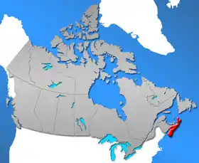
This is a list of communities in the Canadian province of Nova Scotia, as designated by the Union of Nova Scotia Municipalities. For the purposes of this list, a community is defined as an unincorporated settlement inside or outside a municipality.
Regional municipalities
Nova Scotia has four regional municipalities.
| Name | Population (2021)[1] |
Population (2016)[1] |
Change (%)[1] |
Area (km²)[1] |
Population density[1] |
|---|---|---|---|---|---|
| Cape Breton | 93,694 | 94,285 | −0.6% | 2,419.70 | 38.7 |
| Halifax | 439,819 | 403,131 | +9.1% | 5,475.57 | 80.3 |
| Queens | 10,422 | 10,302 | +1.2% | 2,387.52 | 4.4 |
| West Hants | 19,509 | 19,016 | +2.6% | 1,250.5 | 15.6 |
| Total regional municipalities | 563,444 | 526,734 | +7.0% | 11,533.29 | 48.85 |
Towns
Nova Scotia has 27 towns.
| Name | 2016 Census of Population[2] | ||||
|---|---|---|---|---|---|
| Population (2016) |
Population (2011) |
Change |
Land area (km²) |
Population density | |
| Amherst | 9,413 | 9,717 | −3.1% | 12.07 | 779.9/km2 |
| Annapolis Royal | 491 | 481 | +2.1% | 2.04 | 240.7/km2 |
| Antigonish | 4,364 | 4,524 | −3.5% | 5.01 | 871.1/km2 |
| Berwick | 2,509 | 2,454 | +2.2% | 6.58 | 381.3/km2 |
| Bridgewater | 8,532 | 8,241 | +3.5% | 13.63 | 626.0/km2 |
| Clark's Harbour | 758 | 820 | −7.6% | 2.81 | 269.8/km2 |
| Digby | 2,060 | 2,152 | −4.3% | 3.15 | 654.0/km2 |
| Kentville | 6,271 | 6,094 | +2.9% | 17.26 | 363.3/km2 |
| Lockeport | 531 | 588 | −9.7% | 2.33 | 227.9/km2 |
| Lunenburg | 2,263 | 2,313 | −2.2% | 4.04 | 560.1/km2 |
| Mahone Bay | 1,036 | 943 | +9.9% | 3.12 | 332.1/km2 |
| Middleton | 1,832 | 1,749 | +4.7% | 5.57 | 328.9/km2 |
| Mulgrave | 722 | 794 | −9.1% | 17.83 | 40.5/km2 |
| New Glasgow | 9,075 | 9,562 | −5.1% | 9.96 | 911.1/km2 |
| Oxford | 1,190 | 1,151 | +3.4% | 10.76 | 110.6/km2 |
| Pictou | 3,186 | 3,437 | −7.3% | 8.01 | 397.8/km2 |
| Port Hawkesbury | 3,214 | 3,366 | −4.5% | 8.1 | 396.8/km2 |
| Shelburne | 1,743 | 1,686 | +3.4% | 8.84 | 197.2/km2 |
| Stellarton | 4,208 | 4,485 | −6.2% | 8.99 | 468.1/km2 |
| Stewiacke | 1,373 | 1,438 | −4.5% | 17.62 | 77.9/km2 |
| Trenton | 2,474 | 2,616 | −5.4% | 6.07 | 407.6/km2 |
| Truro | 12,261 | 12,059 | +1.7% | 34.49 | 355.5/km2 |
| Westville | 3,628 | 3,798 | −4.5% | 14.23 | 255.0/km2 |
| Wolfville | 4,195 | 4,269 | −1.7% | 6.46 | 649.4/km2 |
| Yarmouth | 6,518 | 6,761 | −3.6% | 10.57 | 616.7/km2 |
| Total | 97,495 | 99,283 | −1.8% | 248.65 | 392.1/km2 |
| Province of Nova Scotia | 923,598 | 921,727 | +0.2% | 52,942.27 | 17.45/km2 |
Municipal districts
Nova Scotia has 12 municipal districts.
| Name | Incorporation date[3] |
2021 Census of Population[4] | ||||
|---|---|---|---|---|---|---|
| Population (2021) |
Population (2016) |
Change |
Land area (km²) |
Population density (/km2) | ||
| Argyle | April 17, 1879 | 7,870 | 7,899 | −0.4% | 1,526.07 | 5.2 |
| Barrington | April 17, 1879 | 6,523 | 6,646 | −1.9% | 631.98 | 10.3 |
| Chester | April 17, 1879 | 10,693 | 10,310 | +3.7% | 1,120.61 | 9.5 |
| Clare | April 17, 1879 | 7,678 | 8,018 | −4.2% | 851.14 | 9.0 |
| Digby | April 17, 1879 | 7,242 | 7,107 | +1.9% | 1,654.59 | 4.4 |
| East Hants | April 17, 1879 | 22,892 | 22,453 | +2.0% | 1,786.53 | 12.8 |
| Guysborough | April 17, 1879 | 4,585 | 4,670 | −1.8% | 2,115.25 | 2.2 |
| Lunenburg | April 17, 1879 | 25,545 | 24,863 | +2.7% | 1,757.79 | 14.5 |
| Shelburne | April 17, 1879[5] | 4,336 | 4,288 | +1.1% | 1,816.71 | 2.4 |
| St. Mary's | April 17, 1879 | 2,161 | 2,233 | −3.2% | 1,904.08 | 1.1 |
| Yarmouth | April 17, 1879[5] | 10,067 | 9,845 | +2.3% | 584.69 | 17.2 |
| Sub-total district municipalities | ||||||
Villages
Nova Scotia has 21 villages.
Other communities
See also
Notes
References
- 1 2 3 4 5 "Population and dwelling counts: Canada, provinces and territories, and census subdivisions (municipalities), 2021 and 2016 censuses (Nova Scotia)". Statistics Canada. July 8, 2023. Retrieved July 8, 2023.
- ↑ "Population and dwelling counts, for Canada, provinces and territories, and census subdivisions (municipalities), 2016 and 2011 censuses – 100% data (Nova Scotia)". Statistics Canada. February 8, 2017. Retrieved February 11, 2017.
- ↑ "Municipal Incorporation Timeline". Province of Nova Scotia. Retrieved December 6, 2016.
- ↑ "Population and dwelling counts: Canada, provinces and territories, census divisions and census subdivisions (municipalities), Nova Scotia". Statistics Canada. February 9, 2022. Retrieved March 12, 2022.
- 1 2 "The Establishment of Elective Rural Municipal Government in Nova Scotia" (PDF). Government of Nova Scotia: Department of Municipal Affairs. pp. 1, 2. Retrieved December 27, 2016.
- 1 2 3 "Nova Scotia Annual Report of Municipal Statistics for the fiscal year ended March 31, 2015" (PDF). Department of Municipal Affairs. 2015. pp. 12, 126. Retrieved December 5, 2016.
- 1 2 3 "Browse Data by Community Profile, 2011 and 2006 censuses (Nova Scotia)". Government of Nova Scotia. December 18, 2012. Retrieved January 29, 2013.
External links
|
| Provinces | |
|---|---|
| Territories | |
| |
Subdivisions of Nova Scotia | |
|---|---|
| Counties | |
| County municipalities | |
| Regional municipalities | |
| District municipalities | |
| Towns | |
| Villages | |
| Economic regions | |
| Lists | |
| |
This article is issued from Wikipedia. The text is licensed under Creative Commons - Attribution - Sharealike. Additional terms may apply for the media files.