The following list includes all of the Canadian Register of Historic Places listings in Vancouver, British Columbia.
| Name | Address | Coordinates | Government recognition (CRHP №) | Image | |
|---|---|---|---|---|---|
| 102 Powell Street | 100 Powell Street Vancouver BC |
49°16′59″N 123°06′07″W / 49.283°N 123.102°W | Vancouver municipality (7881) |  | |
| 1050 Nicola Street | 1050 Nicola Street Vancouver BC |
49°17′09″N 123°08′06″W / 49.2859°N 123.135°W | Vancouver municipality (10865) |  Upload Photo | |
| 106 West Hastings Street | 106 West Hastings Street Vancouver BC |
49°16′54″N 123°06′29″W / 49.2818°N 123.108°W | Vancouver municipality (8625) |  | |
| 1062 Richards Street | 1062 Richards Street Vancouver BC |
49°16′38″N 123°07′19″W / 49.2771°N 123.122°W | Vancouver municipality (11388) | Upload Photo | |
| 108 West Hastings Street | 108 West Hastings Street Vancouver BC |
49°16′54″N 123°06′29″W / 49.2818°N 123.108°W | Vancouver municipality (8620) |  | |
| 1080 Richards Street | 1080 Richards Street Vancouver BC |
49°16′37″N 123°07′19″W / 49.2769°N 123.122°W | Vancouver municipality (11286) | Upload Photo | |
| 111 East Pender Street | 111 East Pender Street Vancouver BC |
49°16′51″N 123°06′07″W / 49.2807°N 123.102°W | Vancouver municipality (7770) |  | |
| 112 West Hastings Street | 112 West Hastings Street Vancouver BC |
49°16′54″N 123°06′29″W / 49.2818°N 123.108°W | Vancouver municipality (8621) |  | |
| 116 West Hastings Street | 116 West Hastings Street Vancouver BC |
49°16′54″N 123°06′29″W / 49.2818°N 123.108°W | Vancouver municipality (8622) |  | |
| 118 Alexander Street | 118 Alexander Street Vancouver BC |
49°17′02″N 123°06′07″W / 49.2838°N 123.1020°W | Vancouver municipality (7949) |  | |
| 120 Powell Street | 120 Powell Street Vancouver BC |
49°16′59″N 123°06′07″W / 49.283°N 123.102°W | Vancouver municipality (7882) |  | |
| 123 East Hastings Street | 123 East Hastings Street Vancouver BC |
49°16′54″N 123°06′04″W / 49.2817°N 123.101°W | Vancouver municipality (8283) | Upload Photo | |
| 1245 Harwood Street | 1245 Harwood Street Vancouver BC |
49°16′52″N 123°08′10″W / 49.2811°N 123.136°W | Vancouver municipality (11017) | Upload Photo | |
| 127 East Pender Street | 127 East Pender Street Vancouver BC |
49°16′51″N 123°06′04″W / 49.2807°N 123.101°W | Vancouver municipality (7801) |  | |
| 135 East Pender Street | 135 East Pender Street Vancouver BC |
49°16′51″N 123°06′04″W / 49.2807°N 123.101°W | Vancouver municipality (7795) | Upload Photo | |
| 1356 West 13th Avenue | 1356 West 13th Avenue Vancouver BC |
49°15′34″N 123°08′06″W / 49.2595°N 123.135°W | Vancouver municipality (10827) | Upload Photo | |
| 1386 Thurlow Street | 1386 Thurlow Street Vancouver BC |
49°16′42″N 123°08′02″W / 49.2783°N 123.134°W | Vancouver municipality (10666) |  | |
| 1390 Thurlow Street | 1390 Thurlow Street Vancouver BC |
49°16′42″N 123°08′02″W / 49.2783°N 123.134°W | Vancouver municipality (10667) |  | |
| 141 East Pender Street | 141 East Pender Street Vancouver BC |
49°16′51″N 123°06′04″W / 49.2807°N 123.101°W | Vancouver municipality (10623) |  | |
| 144-146 Alexander Street | 118 Alexander Street Vancouver BC |
49°17′01″N 123°06′04″W / 49.2837°N 123.101°W | Vancouver municipality (7950) | Upload Photo | |
| 150 West Hastings Street | 150 West Hastings Street Vancouver BC |
49°16′55″N 123°06′32″W / 49.282°N 123.109°W | Vancouver municipality (8680) |  | |
| 1504 Graveley Street | 1504 Graveley Street Vancouver BC |
49°16′13″N 123°04′23″W / 49.2703°N 123.073°W | Vancouver municipality (11019) | Upload Photo | |
| 151 West Hastings Street | 151 West Hastings Street Vancouver BC |
49°16′57″N 123°06′32″W / 49.2826°N 123.109°W | Vancouver municipality (8682) |  | |
| 152 West Hastings Street | 152 West Hastings Street Vancouver BC |
49°16′55″N 123°06′32″W / 49.282°N 123.109°W | Vancouver municipality (8681) |  | |
| 157 Alexander Street | 157 Alexander Street Vancouver BC |
49°17′03″N 123°06′00″W / 49.2842°N 123.1°W | Vancouver municipality (7862) |  | |
| 1628 Marpole Avenue | 1628 Marpole Avenue Vancouver BC |
49°15′19″N 123°08′28″W / 49.2553°N 123.141°W | Vancouver municipality (10669) |  | |
| 163 East Hastings Street | 163 East Hastings Street Vancouver BC |
49°16′54″N 123°06′04″W / 49.2817°N 123.101°W | Vancouver municipality (8287) | Upload Photo | |
| 166 East Pender Street | 166 East Pender Street Vancouver BC |
49°16′49″N 123°06′04″W / 49.2802°N 123.101°W | Vancouver municipality (7804) |  | |
| 169 East Hastings Street | 169 East Hastings Vancouver BC |
49°16′54″N 123°06′04″W / 49.2817°N 123.101°W | Vancouver municipality (8288) | Upload Photo | |
| 191 Alexander Street | 191 Alexander Street Vancouver BC |
49°17′03″N 123°06′00″W / 49.2843°N 123.1°W | Vancouver municipality (7863) |  | |
| 1927 West 17th Avenue | 1927 West 17th Avenue Vancouver BC |
49°15′23″N 123°08′56″W / 49.2565°N 123.149°W | Vancouver municipality (10668) | Upload Photo | |
| 200 East Pender Street | 200 East Pender Street Vancouver BC |
49°16′49″N 123°05′56″W / 49.2802°N 123.099°W | Vancouver municipality (10624) |  | |
| 21 East Hastings Street | 21 East Hastings Street Vancouver BC |
49°16′54″N 123°06′14″W / 49.2817°N 123.104°W | Vancouver municipality (8269) | Upload Photo | |
| 212 East 38th Avenue | 212 East 38th Avenue Vancouver BC |
49°14′10″N 123°06′04″W / 49.2361°N 123.101°W | Vancouver municipality (10665) |  | |
| 218 Keefer Street | 218 Keefer Street Vancouver BC |
49°16′45″N 123°05′56″W / 49.2792°N 123.099°W | Vancouver municipality (2746) |  | |
| 230-248 Jackson Avenue | 230-248 Jackson Avenue Vancouver BC |
49°16′57″N 123°05′35″W / 49.2824°N 123.093°W | Vancouver municipality (11255) | Upload Photo | |
| 231 East Pender Street | 231 East Pender Street Vancouver BC |
49°16′50″N 123°05′56″W / 49.2806°N 123.099°W | Vancouver municipality (7791) |  | |
| 252 East Georgia Street | 252 East Georgia Street Vancouver BC |
49°16′42″N 123°05′53″W / 49.2783°N 123.098°W | Vancouver municipality (2742) |  | |
| 27 Alexander Street | 27 Alexander Street Vancouver BC |
49°17′01″N 123°06′11″W / 49.2837°N 123.103°W | Vancouver municipality (10744) |  | |
| 27 East Pender Street | 27 East Pender Street Vancouver BC |
49°16′51″N 123°06′14″W / 49.2807°N 123.104°W | Vancouver municipality (7834) |  | |
| 291 East Georgia Street | 291 East Georgia Street Vancouver BC |
49°16′43″N 123°05′49″W / 49.2787°N 123.097°W | Vancouver municipality (7891) | Upload Photo | |
| 304 West 6th Avenue | 304 West 6th Avenue Vancouver BC |
49°15′56″N 123°06′40″W / 49.2655°N 123.111°W | Vancouver municipality (10696) | Upload Photo | |
| 310 West Cordova Street | 310 West Cordova Street Vancouver BC |
49°17′01″N 123°06′36″W / 49.2835°N 123.11°W | Vancouver municipality (8564) |  | |
| 314-316 West Cordova Street | 314-316 West Cordova Street Vancouver BC |
49°17′01″N 123°06′36″W / 49.2836°N 123.11°W | Vancouver municipality (8565) |  | |
| 320 West Cordova Street | 320 West Cordova Street Vancouver BC |
49°17′01″N 123°06′36″W / 49.2836°N 123.11°W | Vancouver municipality (8567) |  | |
| 325 Carrall Street | 325 Carrall Street Vancouver BC |
49°16′55″N 123°06′18″W / 49.282°N 123.105°W | Vancouver municipality (8272) | Upload Photo | |
| 34 Powell Street | 34 Powell Street Vancouver BC |
49°16′59″N 123°06′11″W / 49.283°N 123.103°W | Vancouver municipality (7876) |  | |
| 41 Alexander Street | 41 Alexander Street Vancouver BC |
49°17′01″N 123°06′11″W / 49.2837°N 123.103°W | Vancouver municipality (2813) |  | |
| 42 East Cordova Street | 42 East Cordova Street Vancouver BC |
49°16′56″N 123°06′11″W / 49.2821°N 123.103°W | Vancouver municipality (7901) | Upload Photo | |
| 445 Gore Avenue | 445 Gore Avenue Vancouver BC |
49°16′50″N 123°05′53″W / 49.2806°N 123.098°W | Vancouver municipality (2743) |  | |
| 488 Carrall Street | 488 Carrall Street Vancouver BC |
49°16′51″N 123°06′14″W / 49.2808°N 123.104°W | Vancouver municipality (2810) | Upload Photo | |
| 5 West Hastings Street | 5 West Hastings Street Vancouver BC |
49°16′55″N 123°06′18″W / 49.2819°N 123.105°W | Vancouver municipality (8616) |  | |
| 50 East Cordova Street | 50 East Cordova Street Vancouver BC |
49°16′56″N 123°06′11″W / 49.2821°N 123.103°W | Vancouver municipality (7902) | Upload Photo | |
| 509 Carrall Street | 509 Carrall Street Vancouver BC |
49°16′49″N 123°06′18″W / 49.2804°N 123.105°W | Vancouver municipality (7899) | Upload Photo | |
| 511 Union Street | 511 Union Street Vancouver BC |
49°16′39″N 123°05′35″W / 49.2776°N 123.0931°W | Vancouver municipality (10963) |  | |
| 52 Powell Street | 52 Powell Street Vancouver BC |
49°16′59″N 123°06′11″W / 49.2831°N 123.103°W | Vancouver municipality (7877) |  | |
| 53 West Hastings Street | 53 West Hastings Street Vancouver BC |
49°16′55″N 123°06′23″W / 49.2819°N 123.1064°W | Vancouver municipality (8619) |  | |
| 54 East Cordova Street | 54 East Cordova Street Vancouver BC |
49°16′56″N 123°06′11″W / 49.2821°N 123.103°W | Vancouver municipality (7903) | Upload Photo | |
| Grand Trunk Pacific Hotel | 55 Powell Street Vancouver BC |
49°17′01″N 123°06′11″W / 49.2835°N 123.103°W | Vancouver municipality (7892) |  | |
| 550 Beatty Street | 550 Beatty Street Vancouver BC |
49°16′49″N 123°06′32″W / 49.2803°N 123.109°W | Vancouver municipality (7722) |  | |
| 56 Powell Street | 56 Powell Street Vancouver BC |
49°16′59″N 123°06′11″W / 49.2831°N 123.103°W | Vancouver municipality (7878) |  | |
| 560 Beatty Street | 560 Beatty Street Vancouver BC |
49°16′48″N 123°06′36″W / 49.2801°N 123.11°W | Vancouver municipality (7731) | Upload Photo | |
| 564 Beatty Street | 564 Beatty Street Vancouver BC |
49°17′N 123°07′W / 49.28°N 123.11°W | Vancouver municipality (7732) | Upload Photo | |
| 58 Powell Street | 58 Powell Street Vancouver BC |
49°16′59″N 123°06′11″W / 49.2831°N 123.103°W | Vancouver municipality (7879) |  | |
| 596 West 18th Avenue | 596 West 18th Avenue Vancouver BC |
49°15′18″N 123°07′05″W / 49.2549°N 123.118°W | Vancouver municipality (10694) | Upload Photo | |
| 633 East Hastings Street | 633 East Hastings Street Vancouver BC |
49°16′53″N 123°05′28″W / 49.2815°N 123.091°W | Vancouver municipality (8512) |  | |
| 7 West Hastings Street | 7 West Hastings Street Vancouver BC |
49°16′55″N 123°06′18″W / 49.2819°N 123.105°W | Vancouver municipality (8617) |  | |
| 80 East Pender Street | 80 East Pender Street Vancouver BC |
49°16′49″N 123°06′11″W / 49.2802°N 123.103°W | Vancouver municipality (7837) |  | |
| 827-863 Hamilton Street | 827-863 Hamilton Street Vancouver BC |
49°16′43″N 123°07′01″W / 49.2786°N 123.117°W | Vancouver municipality (11161) | .JPG.webp)
| |
| A. MacDonald and Company Building | 40 Powell Street Vancouver BC |
49°16′59″N 123°06′11″W / 49.283°N 123.103°W | Vancouver municipality (2257) |  | |
| Abrams Block | 212 Carrall Street Vancouver BC |
49°16′58″N 123°06′14″W / 49.2829°N 123.104°W | Vancouver municipality (2512) |  | |
| Afton Hotel | 249 East Hastings Street Vancouver BC |
49°16′54″N 123°05′53″W / 49.2816°N 123.098°W | Vancouver municipality (8507) |  | |
| Alexander Residence | 58 Alexander Street Vancouver BC |
49°17′01″N 123°06′11″W / 49.2835°N 123.103°W | Vancouver municipality (2811) |  | |
| Arco Hotel | 81 West Pender Street Vancouver BC |
49°16′52″N 123°06′25″W / 49.2812°N 123.107°W | Vancouver municipality (7743) |  | |
| Arlington Hotel | 302 West Cordova Street Vancouver BC |
49°17′00″N 123°06′36″W / 49.2834°N 123.11°W | Vancouver municipality (8563) | Upload Photo | |
| Armoury | 620 Beatty Street Vancouver BC |
49°16′47″N 123°06′39″W / 49.2796°N 123.1109°W | Federal (4344) | Upload Photo | |
| Atlantic Furnished Rooms | 81 West Cordova Street Vancouver BC |
49°16′59″N 123°06′25″W / 49.283°N 123.107°W | Vancouver municipality (2540) | Upload Photo | |
| B.C. & Yukon Chamber of Mines Building | 840 West Hastings Street Vancouver BC |
49°17′10″N 123°06′58″W / 49.2861°N 123.116°W | Vancouver municipality (10826) |  | |
| B.C. Market Company Building | 25 Alexander Street Vancouver BC |
49°17′01″N 123°06′14″W / 49.2837°N 123.104°W | Vancouver municipality (2507) |  | |
| B.C. Permanent Building | 330 West Pender Street Vancouver BC |
49°16′56″N 123°06′43″W / 49.2823°N 123.112°W | Vancouver municipality (6842) | 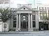 | |
| B.C. Plate Glass and Importing Co. Building | 157 Water Street Vancouver BC |
49°17′04″N 123°06′29″W / 49.2845°N 123.108°W | Vancouver municipality (2537) | 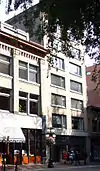 | |
| Balmoral Hotel | 159 East Hastings Street Vancouver BC |
49°16′54″N 123°06′04″W / 49.2817°N 123.101°W | Vancouver municipality (8285) | Upload Photo | |
| Bank of British Columbia | 422 Richards Street Vancouver BC |
49°17′02″N 123°06′44″W / 49.2838°N 123.1123°W | Vancouver municipality (7943) | _422_Richards_St._Vancouver_2020_Dec_14.jpg.webp) | |
| Bank of Commerce | 501 Main Street Vancouver BC |
49°16′49″N 123°05′59″W / 49.2802°N 123.0997°W | Vancouver municipality (2752) |  | |
| Bank of Nova Scotia | 426 West Hastings Street Vancouver BC |
49°17′02″N 123°06′41″W / 49.2838°N 123.1115°W | Vancouver municipality (7932) |  | |
| Bayview Community School | 2251 Collingwood Street Vancouver BC |
49°15′59″N 123°10′59″W / 49.2664°N 123.183°W | Vancouver municipality (11313) | Upload Photo | |
| BC Collateral and Loan Buildings | 77 East Hastings Street Vancouver BC |
49°16′54″N 123°06′11″W / 49.2817°N 123.103°W | Vancouver municipality (5260) | Upload Photo | |
| BC Electric Railway Company Terminal | 425 Carrall Street Vancouver BC |
49°16′52″N 123°06′18″W / 49.2811°N 123.105°W | Vancouver municipality (2609) | Upload Photo | |
| Beach Town House Apartments | 1949 Beach Avenue Vancouver BC |
49°17′21″N 123°08′35″W / 49.2892°N 123.143°W | Vancouver municipality (8775) | Upload Photo | |
| Beckett House | 125 Boundary Road Vancouver BC |
49°17′01″N 123°01′26″W / 49.2836°N 123.024°W | Vancouver municipality (11020) |  | |
| Belmont Building | 241 East Hasting Street Vancouver BC |
49°16′53″N 123°05′55″W / 49.2813°N 123.0986°W | Vancouver municipality (8502) | Upload Photo | |
| Bessborough Armoury | 2025 West 11th Street Vancouver BC |
49°15′44″N 123°09′04″W / 49.2622°N 123.151°W | Federal (9513) |  | |
| Blair House | 1550 Harwood Street Vancouver BC |
49°17′01″N 123°08′25″W / 49.2835°N 123.1402°W | Vancouver municipality (11016) | Upload Photo | |
| Bloedel Conservatory | 4600 Cambie Street Vancouver BC |
49°14′32″N 123°06′50″W / 49.2421°N 123.114°W | Vancouver municipality (8776) |  | |
| Bodega Hotel | 225 Carrall Street Vancouver BC |
49°16′58″N 123°06′18″W / 49.2829°N 123.105°W | Vancouver municipality (2514) |  | |
| Boeur House and Cottage | 3532 West 5th Avenue Vancouver BC |
49°16′03″N 123°10′59″W / 49.2674°N 123.183°W | Vancouver municipality (10923) | Upload Photo | |
| Boulder Hotel | 9 West Cordova Street Vancouver BC |
49°16′57″N 123°06′17″W / 49.2825°N 123.1047°W | Vancouver municipality (2530) | Upload Photo | |
| Bowman Block | 522 Beatty Street Vancouver BC |
49°16′51″N 123°06′32″W / 49.2807°N 123.109°W | Vancouver municipality (2046) | Upload Photo | |
| Boyd Building | 88 East Cordova Street Vancouver BC |
49°16′56″N 123°06′11″W / 49.2821°N 123.103°W | Vancouver municipality (7911) | Upload Photo | |
| British Columbia Securities Building | 402 West Pender Street Vancouver BC |
49°16′58″N 123°06′43″W / 49.2827°N 123.112°W | Vancouver municipality (7938) |  | |
| Brown and Company Warehouse | 171 Water Street Vancouver BC |
49°17′04″N 123°06′29″W / 49.2845°N 123.108°W | Vancouver municipality (2539) |  | |
| Brunswick Pool Room | 26 East Hastings Street Vancouver BC |
49°16′52″N 123°06′14″W / 49.2811°N 123.104°W | Vancouver municipality (8280) | Upload Photo | |
| Building 1, Administration Building | 1200 Stanley Park Drive Vancouver BC |
49°17′46″N 123°07′23″W / 49.296°N 123.123°W | Federal (10841) | Upload Photo | |
| Burns Block | 342 Water Street Vancouver BC |
49°17′04″N 123°06′35″W / 49.2845°N 123.1098°W | Vancouver municipality (2554) | Upload Photo | |
| Burns Block | 18 West Hastings Street Vancouver BC |
49°17′03″N 123°06′36″W / 49.2843°N 123.11°W | Vancouver municipality (8618) |  | |
| Byrnes Block | 2 Water Street Vancouver BC |
49°17′00″N 123°06′18″W / 49.2832°N 123.105°W | Vancouver municipality (2529) | 
| |
| Callister Block | 30 West Cordova Street Vancouver BC |
49°16′57″N 123°06′22″W / 49.2824°N 123.106°W | Vancouver municipality (8559) | Upload Photo | |
| Cambie Heritage Boulevard | 4100-8400 Cambie Street Vancouver BC |
49°13′48″N 123°07′01″W / 49.2299°N 123.117°W | Vancouver municipality (11506) | Upload Photo | |
| Cambie Hotel | 310 Cambie Street Vancouver BC |
49°16′59″N 123°06′32″W / 49.2831°N 123.109°W | Vancouver municipality (2802) |  | |
| Campbell House | 2728 Pandora Street Vancouver BC |
49°16′58″N 123°02′55″W / 49.2827°N 123.0485°W | Vancouver municipality (10968) | Upload Photo | |
| Canada Permanent Building | 432 Richards Street Vancouver BC |
49°17′01″N 123°06′45″W / 49.2836°N 123.1125°W | Vancouver municipality (6841) | _02.jpg.webp) | |
| Canadian National Railways / VIA Rail Station | 1150 Station Street Vancouver BC |
49°16′26″N 123°05′53″W / 49.274°N 123.098°W | Federal (4527) |  | |
| Canadian Pacific Telegraph Building | 432 West Hastings Street Vancouver BC |
49°17′01″N 123°06′43″W / 49.2836°N 123.112°W | Vancouver municipality (7962) |  | |
| Canuck Place | 1690 Matthews Avenue Vancouver BC |
49°15′06″N 123°08′35″W / 49.2517°N 123.143°W | Vancouver municipality (11157) | Upload Photo | |
| Carnegie Centre | 401 Main Street Vancouver BC |
49°16′52″N 123°06′00″W / 49.281°N 123.1°W | Vancouver municipality (2749) | 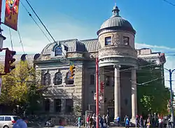 | |
| Central City Mission | 233 Abbott Street Vancouver BC |
49°17′00″N 123°06′25″W / 49.2833°N 123.107°W | Vancouver municipality (2503) | Upload Photo | |
| Ceperley Rounsfell Building | 848 West Hastings Street Vancouver BC |
49°17′10″N 123°06′58″W / 49.2862°N 123.116°W | Vancouver municipality (10825) |  | |
| Chan House | 658 Keefer Street Vancouver BC |
49°16′44″N 123°05′24″W / 49.279°N 123.09°W | Vancouver municipality (10866) |  | |
| Cheng Wing Yeong Tong Society Building | 79 East Pender Street Vancouver BC |
49°16′51″N 123°06′11″W / 49.2807°N 123.103°W | Vancouver municipality (7836) |  | |
| Chin Wing Chun Society Building | 158 East Pender Street Vancouver BC |
49°16′49″N 123°06′04″W / 49.2802°N 123.101°W | Vancouver municipality (7803) |  | |
| Chinese Benevolent Association Building | 104 East Pender Street Vancouver BC |
49°16′49″N 123°06′07″W / 49.2802°N 123.102°W | Vancouver municipality (7800) |  | |
| Chinese Freemasons Building | 5 West Pender Street Vancouver BC |
49°16′51″N 123°06′18″W / 49.2808°N 123.105°W | Vancouver municipality (1511) |  | |
| Chinese School | 121 East Pender Street Vancouver BC |
49°16′51″N 123°06′04″W / 49.2807°N 123.101°W | Vancouver municipality (7794) |  | |
| Chinese Theatre | 124 East Pender Street Vancouver BC |
49°16′49″N 123°06′07″W / 49.2802°N 123.102°W | Vancouver municipality (7771) |  | |
| Chinese Times Building | 1 East Pender Street Vancouver BC |
49°16′51″N 123°06′14″W / 49.2807°N 123.104°W | Vancouver municipality (1187) |  | |
| Chrysler Building | 26 SW Marine Drive Vancouver BC |
49°12′39″N 123°06′25″W / 49.2109°N 123.107°W | Vancouver municipality (11254) | ||
| City Hotel | 90 Alexander Street Vancouver BC |
49°17′01″N 123°06′07″W / 49.2835°N 123.102°W | Vancouver municipality (2812) |  | |
| Clark House | 132 West 10th Avenue Vancouver BC |
49°15′44″N 123°06′29″W / 49.2621°N 123.1080°W | Vancouver municipality (10961) | Upload Photo | |
| Coastal Church | 1160 West Georgia Street Vancouver BC |
49°17′12″N 123°07′28″W / 49.2866°N 123.1245°W | Vancouver municipality (11022) |  | |
| Commercial Block | 211 Columbia Street Vancouver BC |
49°16′59″N 123°06′08″W / 49.2830°N 123.1022°W | Vancouver municipality (2808) | Upload Photo | |
| Condie Residence | 335 West 11th Avenue Vancouver BC |
49°15′41″N 123°06′43″W / 49.2615°N 123.112°W | Vancouver municipality (10671) |  | |
| Cook Block | 105 West Cordova Street Vancouver BC |
49°17′00″N 123°06′25″W / 49.2832°N 123.107°W | Vancouver municipality (2505) | Upload Photo | |
| CPR Roundhouse | 181 Roundhouse Mews Vancouver BC |
49°16′24″N 123°07′19″W / 49.2733°N 123.1220°W | British Columbia (20046) | Upload Photo | |
| Crane Building | 540 Beatty Street Vancouver BC |
49°16′50″N 123°06′32″W / 49.2805°N 123.109°W | Vancouver municipality (2047) | Upload Photo | |
| Crosby House | 1529 West 33rd Avenue Vancouver BC |
49°14′31″N 123°08′26″W / 49.2419°N 123.1405°W | Vancouver municipality (10965) | Upload Photo | |
| Curry Residence | 3409 Arbutus Street Vancouver BC |
49°15′22″N 123°09′11″W / 49.256°N 123.153°W | Vancouver municipality (10670) | Upload Photo | |
| Customs Examining Warehouse | 326 Howe Street Vancouver BC |
49°17′10″N 123°06′52″W / 49.2862°N 123.1145°W | Federal (4153) | Upload Photo | |
| Dal Grauer Substation | 944 Burrard Street Vancouver BC |
49°16′53″N 123°07′30″W / 49.2815°N 123.125°W | Vancouver municipality (8777) | Upload Photo | |
| Dawson Building | 375 Main Street Vancouver BC |
49°16′54″N 123°06′00″W / 49.2816°N 123.1°W | Vancouver municipality (8556) | Upload Photo | |
| Des Brisay Block | 122 Water Street Vancouver BC |
49°17′01″N 123°06′25″W / 49.2836°N 123.107°W | Vancouver municipality (2786) |  | |
| Desrosiers Block | 6 East Hastings Street Vancouver BC |
49°16′52″N 123°06′14″W / 49.2811°N 123.104°W | Vancouver municipality (8271) | Upload Photo | |
| Dodek Residence | 6821 Laurel Street Vancouver BC |
49°13′25″N 123°07′34″W / 49.2235°N 123.126°W | Vancouver municipality (8778) | Upload Photo | |
| Dominion Building | 207 West Hastings Street Vancouver BC |
49°16′59″N 123°06′36″W / 49.283°N 123.11°W | Vancouver municipality (8684) |  | |
| Dominion Hotel | 210 Abbott Street Vancouver BC |
49°17′01″N 123°06′22″W / 49.2836°N 123.106°W | Vancouver municipality (2502) |  | |
| Dougall House | 306 Abbott Street Vancouver BC |
49°16′58″N 123°06′25″W / 49.2827°N 123.107°W | Vancouver municipality (2804) | Upload Photo | |
| Downs Residence | 6275 Dunbar Street Vancouver BC |
49°13′46″N 123°11′10″W / 49.2295°N 123.186°W | Vancouver municipality (8268) | Upload Photo | |
| Dr. Sun Yat-Sen Classical Chinese Garden and Park | 578 Carrall Street Vancouver BC |
49°16′47″N 123°06′13″W / 49.2796°N 123.1037°W | Vancouver municipality (20664) |  | |
| Dumoine Lodge | 1498 Laurier Avenue Vancouver BC |
49°15′02″N 123°08′17″W / 49.2505°N 123.138°W | Vancouver municipality (10964) | Upload Photo | |
| Dunn Block | 110 Carrall Street Vancouver BC |
49°17′01″N 123°06′14″W / 49.2837°N 123.104°W | Vancouver municipality (2506) |  | |
| Dunn-Miller Block | 8 West Cordova Street Vancouver BC |
49°16′56″N 123°06′18″W / 49.2823°N 123.105°W | Vancouver municipality (8557) | Upload Photo | |
| Edgett Building | 440 Cambie Street Vancouver BC |
49°16′54″N 123°06′36″W / 49.2817°N 123.11°W | Vancouver municipality (6507) | _440_Cambie_St._(2020_Dec_14).jpg.webp) | |
| Edward Hotel | 302 Water Street Vancouver BC |
49°17′03″N 123°06′32″W / 49.2841°N 123.109°W | Vancouver municipality (2547) | Upload Photo | |
| Europe Hotel | 43 Powell Street Vancouver BC |
49°17′00″N 123°06′11″W / 49.2834°N 123.103°W | Vancouver municipality (7960) |  | |
| Europe Hotel Annex | 43 Powell Street Vancouver BC |
49°17′00″N 123°06′11″W / 49.2834°N 123.103°W | Vancouver municipality (7961) |  | |
| Evergreen Building | 1285 West Pender Street Vancouver BC |
49°17′21″N 123°07′30″W / 49.2891°N 123.125°W | Vancouver municipality (10822) | 
| |
| F. Morgan Building | 242 East Hastings Street Vancouver BC |
49°16′52″N 123°05′56″W / 49.281°N 123.099°W | Vancouver municipality (8508) |  | |
| F.R. Stewart and Company Building | 131 Water Street Vancouver BC |
49°17′04″N 123°06′25″W / 49.2844°N 123.107°W | Vancouver municipality (2542) |  | |
| Fairmont Training Academy | 4949 Heather Street Vancouver BC |
49°14′21″N 123°07′19″W / 49.2393°N 123.122°W | Federal (4766) |  | |
| Federal Motor Company Building | 1295 Seymour Street Vancouver BC |
49°16′33″N 123°07′37″W / 49.2757°N 123.127°W | Vancouver municipality (10824) |  | |
| Ferguson Block | 6 Powell Street Vancouver BC |
49°16′59″N 123°06′14″W / 49.2831°N 123.104°W | Vancouver municipality (2522) |  | |
| Ferrera Court | 504 East Hastings Street Vancouver BC |
49°16′51″N 123°05′35″W / 49.2809°N 123.093°W | Vancouver municipality (8511) |  | |
| Filion Block | 204 Carrall Street Vancouver BC |
49°16′59″N 123°06′14″W / 49.283°N 123.104°W | Vancouver municipality (2511) | Upload Photo | |
| First Baptist Church | 969 Burrard Street Vancouver BC |
49°16′53″N 123°07′33″W / 49.2814°N 123.1257°W | Vancouver municipality (10919) |  | |
| First Rogers Block | 303 West Hastings Street Vancouver BC |
49°16′58″N 123°06′36″W / 49.2829°N 123.1101°W | Vancouver municipality (7929) | Upload Photo | |
| Flack Block | 163 West Hastings Street Vancouver BC |
49°16′57″N 123°06′32″W / 49.2826°N 123.109°W | Vancouver municipality (5094) |  | |
| Fleck Brothers Building | 103 Powell Street Vancouver BC |
49°17′01″N 123°06′07″W / 49.2835°N 123.102°W | Vancouver municipality (7893) |  | |
| Former B.C. Hydro Building | 989 Nelson Street Vancouver BC |
49°16′52″N 123°07′30″W / 49.2811°N 123.125°W | Vancouver municipality (8779) |  | |
| Former Main Post Office | 701 West Hastings Street Vancouver BC |
49°17′10″N 123°07′01″W / 49.286°N 123.117°W | Federal (14821) |  | |
| Former Vancouver Law Courts (Vancouver Art Gallery) |
750 Hornby Street, Vancouver, BC V6Z 2H7 | 49°16′58″N 123°7′12″W / 49.28278°N 123.12000°W | Federal (7439) | Q371960 |  More images |
| Former Vancouver Public Library | 750 Burrard Street Vancouver BC |
49°17′00″N 123°07′19″W / 49.2834°N 123.122°W | Vancouver municipality (8944) |  | |
| Fortin Building | 57 West Cordova Street Vancouver BC |
49°16′59″N 123°06′22″W / 49.283°N 123.106°W | Vancouver municipality (2517) | Upload Photo | |
| Fountain Chapel | 823 Jackson Avenue Vancouver BC |
49°16′37″N 123°05′38″W / 49.2769°N 123.094°W | Vancouver municipality (10695) | Upload Photo | |
| Gardner Residence | 3152 West 49th Avenue Vancouver BC |
49°13′36″N 123°10′30″W / 49.2268°N 123.175°W | Vancouver municipality (8784) | Upload Photo | |
| Gastown Historic District | 49°17′5″N 123°6′40″W / 49.28472°N 123.11111°W | Federal (16124) | Q1495636 |  More images | |
| General Gordon Elementary School | 2896 West 6th Avenue Vancouver BC |
49°15′58″N 123°10′12″W / 49.266°N 123.17°W | Vancouver municipality (11311) | Upload Photo | |
| General Wolfe Elementary School | 4251 Ontario Street Vancouver BC |
49°14′50″N 123°06′21″W / 49.2473°N 123.1057°W | Vancouver municipality (11308) |  | |
| Glenesk Residence | 2978 West 5th Avenue Vancouver BC |
49°16′02″N 123°10′19″W / 49.2673°N 123.172°W | Vancouver municipality (10693) |  | |
| Granville Hotel | 24-26 Water Street Vancouver BC |
49°17′01″N 123°06′18″W / 49.2836°N 123.1051°W | Vancouver municipality (1521) | Upload Photo | |
| Great Western Hotel | 110 Cambie Street Vancouver BC |
49°17′04″N 123°06′29″W / 49.2845°N 123.108°W | Vancouver municipality (2508) |  | |
| Greenshields Building | 341 & 345 Water Street Vancouver BC |
49°17′05″N 123°06′36″W / 49.2848°N 123.11°W | Vancouver municipality (2555) | 
| |
| Hampton Hotel | 124 Powell Street Vancouver BC |
49°16′59″N 123°06′04″W / 49.283°N 123.101°W | Vancouver municipality (7883) |  | |
| Hanning House | 1826 Blanca Street Vancouver BC |
49°16′16″N 123°12′54″W / 49.2712°N 123.215°W | Vancouver municipality (10921) | Upload Photo | |
| Harbour Block | 73 Alexander Street Vancouver BC |
49°17′02″N 123°06′11″W / 49.2838°N 123.103°W | Vancouver municipality (7860) |  | |
| Harper Warehouse | 151 Water Street Vancouver BC |
49°17′04″N 123°06′29″W / 49.2844°N 123.108°W | Vancouver municipality (2541) |  | |
| Hartney Chambers | 347 West Pender Street Vancouver BC |
49°16′58″N 123°06′43″W / 49.2828°N 123.112°W | Vancouver municipality (7937) |  | |
| Henderson Block | 122 West Hastings Street Vancouver BC |
49°16′55″N 123°06′29″W / 49.2819°N 123.108°W | Vancouver municipality (8623) |  | |
| Hendrix House | 827 East Georgia Street Vancouver BC |
49°16′43″N 123°05′13″W / 49.2786°N 123.087°W | Vancouver municipality (10967) |  | |
| Hickey Block | 228 Abbott Street Vancouver BC |
49°17′00″N 123°06′22″W / 49.2832°N 123.106°W | Vancouver municipality (2510) | Upload Photo | |
| Holden Building | 16 East Hastings Street Vancouver BC |
49°16′52″N 123°06′14″W / 49.2811°N 123.104°W | Vancouver municipality (7982) | Upload Photo | |
| Holland Block | 350 Water Street Vancouver BC |
49°17′04″N 123°06′36″W / 49.2844°N 123.11°W | Vancouver municipality (2559) | Upload Photo | |
| Homer Street Arcade | 332 Water Street Vancouver BC |
49°17′03″N 123°06′36″W / 49.2842°N 123.11°W | Vancouver municipality (2553) |  | |
| Horne Block | 313 Cambie Street Vancouver BC |
49°17′00″N 123°06′32″W / 49.2833°N 123.109°W | Vancouver municipality (8273) | Upload Photo | |
| Hotel Connaught | 435 West Pender Street Vancouver BC |
49°17′00″N 123°06′43″W / 49.2834°N 123.112°W | Vancouver municipality (7942) |  | |
| Hotel Empress | 235 East Hastings Street Vancouver BC |
49°16′54″N 123°05′56″W / 49.2816°N 123.099°W | Vancouver municipality (8465) |  | |
| Hotel Georgia | 801 West Georgia Street Vancouver BC |
49°17′01″N 123°07′08″W / 49.2836°N 123.119°W | Vancouver municipality (11158) |  | |
| Hotel Metropole | 320 Abbott Street Vancouver BC |
49°16′57″N 123°06′25″W / 49.2825°N 123.107°W | Vancouver municipality (2801) | Upload Photo | |
| Hotel Stanley | 36 Blood Alley Square Vancouver BC |
49°16′58″N 123°06′18″W / 49.2828°N 123.105°W | Vancouver municipality (2531) |  | |
| Hotel Winters | 102 Water Street Vancouver BC |
49°17′01″N 123°06′25″W / 49.2837°N 123.107°W | Vancouver municipality (2528) |  | |
| Hudson's Bay Company Warehouse | 321 Water Street Vancouver BC |
49°17′05″N 123°06′32″W / 49.2847°N 123.109°W | Vancouver municipality (2552) |  | |
| Hutchinson Block | 429 West Pender Street Vancouver BC |
49°17′00″N 123°06′43″W / 49.2833°N 123.112°W | Vancouver municipality (7940) |  | |
| Hycroft | 1489 McRae Avenue Vancouver BC |
49°15′25″N 123°08′14″W / 49.2570°N 123.1371°W | Vancouver municipality (20663) | Upload Photo | |
| International Order of Odd Fellows Hall | 505 Hamilton Street Vancouver BC |
49°16′56″N 123°06′40″W / 49.2821°N 123.111°W | Vancouver municipality (6508) | _505_Hamilton_St._Vancouver._2020_Dec_14.jpg.webp)
| |
| J.W. Horne Block | 315 West Cordova Street Vancouver BC |
49°17′02″N 123°06′32″W / 49.284°N 123.109°W | Vancouver municipality (2520) |  | |
| John Oliver Secondary School | 530 East 41st Avenue Vancouver BC |
49°13′55″N 123°05′35″W / 49.2319°N 123.093°W | Vancouver municipality (10626) |  | |
| Jones Block | 407 West Cordova Street Vancouver BC |
49°17′04″N 123°06′36″W / 49.2844°N 123.11°W | Vancouver municipality (2521) | Upload Photo | |
| Kane Block | 50 Water Street Vancouver BC |
49°17′01″N 123°06′22″W / 49.2835°N 123.106°W | Vancouver municipality (1173) |  | |
| Kelly, Douglas and Co. Warehouse | 375 Water Street Vancouver BC |
49°17′06″N 123°06′36″W / 49.2849°N 123.11°W | Vancouver municipality (2558) |  | |
| Kendrick House | 2543 Pandora Street Vancouver BC |
49°17′00″N 123°03′13″W / 49.2832°N 123.0535°W | Vancouver municipality (10966) |  | |
| King Block | 224 East Georgia Street Vancouver BC |
49°16′42″N 123°05′56″W / 49.2783°N 123.099°W | Vancouver municipality (7890) |  | |
| Kitsilano Secondary School | 2550 West 10th Avenue Vancouver BC |
49°15′44″N 123°09′50″W / 49.2621°N 123.164°W | Vancouver municipality (10625) | Upload Photo | |
| L'École Bilingue | 1166 West 14th Avenue Vancouver BC |
49°15′30″N 123°07′48″W / 49.2583°N 123.13°W | Vancouver municipality (11310) | Upload Photo | |
| Laura Secord Elementary School | 2500 Lakewood Drive Vancouver BC |
49°15′42″N 123°03′43″W / 49.2618°N 123.0620°W | Vancouver municipality (11307) | Upload Photo | |
| Leckie Building | 220 Cambie Street Vancouver BC |
49°17′02″N 123°06′29″W / 49.284°N 123.108°W | Vancouver municipality (2509) |  | |
| Leeson, Dickie, Gross & Co. Warehouse | 134 Abbott Street Vancouver BC |
49°17′03″N 123°06′22″W / 49.2841°N 123.106°W | Vancouver municipality (2501) |  | |
| Leslie House | 1380 Hornby Street Vancouver BC |
49°16′35″N 123°07′52″W / 49.2764°N 123.131°W | Vancouver municipality (10697) | Upload Photo | |
| Lim Sai Hor Association Building | 525 Carrall Street Vancouver BC |
49°16′49″N 123°06′18″W / 49.2802°N 123.105°W | Vancouver municipality (2809) | Upload Photo | |
| Lions Gate Bridge | 49°18′55″N 123°8′18″W / 49.31528°N 123.13833°W | Federal (11711) | Q124352 | 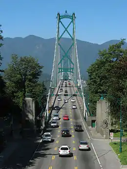 More images | |
| Lipsett Building | 66 Water Street Vancouver BC |
49°17′01″N 123°06′22″W / 49.2835°N 123.106°W | Vancouver municipality (2525) |  | |
| London Hotel | 208 East Georgia Street Vancouver BC |
49°16′42″N 123°05′56″W / 49.2784°N 123.099°W | Vancouver municipality (7889) |  | |
| Lord Kitchener Elementary School | 4055 Blenheim Street Vancouver BC |
49°15′02″N 123°10′48″W / 49.2506°N 123.18°W | Vancouver municipality (11312) | Upload Photo | |
| Lord Strathcona Community School | 592 East Pender Street Vancouver BC |
49°16′47″N 123°05′31″W / 49.2798°N 123.092°W | Vancouver municipality (11304) |  | |
| Lord Tennyson Elementary School | 1936 West 10th Avenue Vancouver BC |
49°15′44″N 123°08′56″W / 49.2623°N 123.149°W | Vancouver municipality (11305) | Upload Photo | |
| Lovell Block | 117 Water Street Vancouver BC |
49°17′03″N 123°06′25″W / 49.2842°N 123.107°W | Vancouver municipality (2535) |  | |
| Lumbermen's Building | 509 Richards Street Vancouver BC |
49°17′00″N 123°06′47″W / 49.2833°N 123.113°W | Vancouver municipality (2048) | 
| |
| MacMillan Bloedel Building | 1075 West Georgia Street Vancouver BC |
49°17′09″N 123°07′19″W / 49.2858°N 123.122°W | Vancouver municipality (8781) |  | |
| Magee House | 6475 Balaclava Street Vancouver BC |
49°13′42″N 123°10′33″W / 49.2283°N 123.1759°W | Vancouver municipality (10828) | Upload Photo | |
| Mah Society Building | 137 East Pender Street Vancouver BC |
49°16′51″N 123°06′04″W / 49.2807°N 123.101°W | Vancouver municipality (7802) |  | |
| Malkin Building | 55 Water Street Vancouver BC |
49°17′02″N 123°06′18″W / 49.284°N 123.105°W | Vancouver municipality (2604) |  | |
| Manitoba Hotel | 50 West Cordova Street Vancouver BC |
49°16′57″N 123°06′22″W / 49.2825°N 123.106°W | Vancouver municipality (8561) | Upload Photo | |
| Maple Grove Elementary School | 6199 Cypress Street Vancouver BC |
49°13′48″N 123°09′00″W / 49.2299°N 123.15°W | Vancouver municipality (11306) | Upload Photo | |
| Marpole Midden | 49°12′14″N 123°8′20″W / 49.20389°N 123.13889°W | Federal (15609) | Q5599542 |  More images | |
| Martin and Robertson Warehouse | 311 Water Street Vancouver BC |
49°17′05″N 123°06′32″W / 49.2846°N 123.109°W | Vancouver municipality (2550) | | |
| May Wah Hotel | 258 East Pender Street Vancouver BC |
49°16′48″N 123°05′53″W / 49.2801°N 123.098°W | Vancouver municipality (7861) |  | |
| McBeth and Campbell Building | 326 West Pender Street Vancouver BC |
49°16′56″N 123°06′43″W / 49.2822°N 123.112°W | Vancouver municipality (6843) |  | |
| McClary Manufacturing Company Building | 305 Water Street Vancouver BC |
49°17′05″N 123°06′32″W / 49.2846°N 123.109°W | Vancouver municipality (2548) | Upload Photo | |
| McConnell Block | 350 Water Street Vancouver BC |
49°17′04″N 123°06′36″W / 49.2844°N 123.11°W | Vancouver municipality (2556) | Upload Photo | |
| McIntosh Block | 36 West Cordova Street Vancouver BC |
49°16′57″N 123°06′22″W / 49.2825°N 123.106°W | Vancouver municipality (8560) | Upload Photo | |
| McKinnon House | 2628 West 5th Avenue Vancouver BC |
49°16′02″N 123°09′54″W / 49.2672°N 123.165°W | Vancouver municipality (11015) | Upload Photo | |
| McLennan and McFeely Building | 55 East Cordova Street Vancouver BC |
49°16′57″N 123°06′11″W / 49.2826°N 123.103°W | Vancouver municipality (1174) | Upload Photo | |
| McLuckie Warehouse | 353 Water Street Vancouver BC |
49°17′05″N 123°06′36″W / 49.2848°N 123.11°W | Vancouver municipality (2557) | Upload Photo | |
| McPherson Building | 322 Water Street Vancouver BC |
49°17′03″N 123°06′32″W / 49.2842°N 123.109°W | Vancouver municipality (2551) |  | |
| Merchants Bank | 1 West Hastings Street Vancouver BC |
49°16′54″N 123°06′18″W / 49.2818°N 123.105°W | Vancouver municipality (1518) | Upload Photo | |
| Ming Wo Building | 23 East Pender Street Vancouver BC |
49°16′51″N 123°06′14″W / 49.2807°N 123.104°W | Vancouver municipality (7833) |  | |
| Mission House | 150 Alexander Street Vancouver BC |
49°17′02″N 123°06′04″W / 49.2838°N 123.101°W | Vancouver municipality (7951) | Upload Photo | |
| Mission to Seafarers | 401 East Waterfront Road Vancouver BC |
49°17′09″N 123°05′42″W / 49.2859°N 123.095°W | Vancouver municipality (11155) | Upload Photo | |
| Murrin Substation | 721 Main Street Vancouver BC |
49°16′42″N 123°06′00″W / 49.2782°N 123.1°W | Vancouver municipality (2748) | Upload Photo | |
| Nagle Brothers Garage | 12 Water Street Vancouver BC |
49°17′00″N 123°06′18″W / 49.2833°N 123.105°W | Vancouver municipality (2524) |  | |
| Nationalist League Building | 525 Gore Avenue Vancouver BC |
49°16′48″N 123°05′53″W / 49.2801°N 123.098°W | Vancouver municipality (2744) |  | |
| New Columbia Hotel | 303 Columbia Street Vancouver BC |
49°16′56″N 123°06′07″W / 49.2821°N 123.102°W | Vancouver municipality (7900) | Upload Photo | |
| New Fountain Hotel | 36 Blood Alley Square Vancouver BC |
49°16′58″N 123°06′22″W / 49.2829°N 123.106°W | Vancouver municipality (2532) |  | |
| News-Advertiser Building | 303 West Pender Street Vancouver BC |
49°16′57″N 123°06′40″W / 49.2824°N 123.111°W | Vancouver municipality (7934) |  | |
| Nichol House | 1402 McRae Avenue Vancouver BC |
49°15′23″N 123°08′13″W / 49.2565°N 123.137°W | Vancouver municipality (11159) | 
| |
| Oppenheimer Building | 100 Powell Street Vancouver BC |
49°16′59″N 123°06′07″W / 49.283°N 123.102°W | Vancouver municipality (7880) | Upload Photo | |
| Opsal Steel Building | 97 East 2nd Avenue Vancouver BC |
49°16′10″N 123°06′11″W / 49.2695°N 123.103°W | Vancouver municipality (11018) | Upload Photo | |
| Orpheum Theatre | 49°16′47.75″N 123°7′14.05″W / 49.2799306°N 123.1205694°W | Federal (7645) | Q7103961 |  More images | |
| Pacific Transfer Company Building | 120 East Cordova Street Vancouver BC |
49°16′56″N 123°06′07″W / 49.2821°N 123.102°W | Vancouver municipality (2741) | Upload Photo | |
| Pantages Theatre | 144 East Hastings Street Vancouver BC |
49°16′52″N 123°06′04″W / 49.2811°N 123.101°W | Vancouver municipality (8284) |  | |
| Park Grocery and Woodside Apartments | 2598 Eton Street Vancouver BC |
49°17′16″N 123°03′08″W / 49.2877°N 123.0521°W | Vancouver municipality (20665) |  | |
| Pender Hotel | 31 West Pender Street Vancouver BC |
49°16′52″N 123°06′22″W / 49.2811°N 123.106°W | Vancouver municipality (7742) | Upload Photo | |
| Pennsylvania Hotel | 412 Carrall Street Vancouver BC |
49°16′52″N 123°06′14″W / 49.2811°N 123.104°W | Vancouver municipality (5095) |  | |
| Phoenix Hotel | 237 East Hastings Street Vancouver BC |
49°16′53″N 123°05′55″W / 49.2813°N 123.0987°W | Vancouver municipality (8501) | Upload Photo | |
| Pither & Leiser Building | 165 Water Street Vancouver BC |
49°17′04″N 123°06′29″W / 49.2845°N 123.108°W | Vancouver municipality (2538) |  | |
| Prince Rupert Meat Company Building | 73 Water Street Vancouver BC |
49°17′03″N 123°06′22″W / 49.2841°N 123.106°W | Vancouver municipality (2526) |  | |
| Province Building | 198 West Hastings Street Vancouver BC |
49°16′56″N 123°06′32″W / 49.2821°N 123.109°W | Vancouver municipality (8683) | Upload Photo | |
| Queen Elizabeth Elementary School | 4102 West 16th Avenue Vancouver BC |
49°15′26″N 123°12′00″W / 49.2573°N 123.2°W | Vancouver municipality (10628) | Upload Photo | |
| Queen Elizabeth Theatre | 688 Hamilton Street Vancouver BC |
49°16′49″N 123°06′47″W / 49.2802°N 123.113°W | Vancouver municipality (8921) | ||
| R. V. Winch Building | 739 West Hastings Street Vancouver BC |
49°15′00″N 123°07′01″W / 49.25°N 123.117°W | Federal (4154) | Upload Photo | |
| Rainier Hotel | 309 Carrall Street Vancouver BC |
49°16′56″N 123°06′18″W / 49.2822°N 123.105°W | Vancouver municipality (2803) | Upload Photo | |
| Rainsford and Co. Warehouse | 115 Water Street Vancouver BC |
49°17′03″N 123°06′25″W / 49.2842°N 123.107°W | Vancouver municipality (2534) |  | |
| Ralph Block | 126 West Hastings Street Vancouver BC |
49°16′55″N 123°06′29″W / 49.2819°N 123.108°W | Vancouver municipality (8624) | Upload Photo | |
| Rand House | 995 Bute Street Vancouver BC |
49°17′02″N 123°07′48″W / 49.284°N 123.1301°W | Vancouver municipality (10962) |  | |
| Rees & Higgins Block | 238 Abbott Street Vancouver BC |
49°16′59″N 123°06′22″W / 49.2831°N 123.106°W | Vancouver municipality (6316) | Upload Photo | |
| Regal Place | 146 West Hastings Street Vancouver BC |
49°16′56″N 123°06′31″W / 49.2823°N 123.1086°W | Vancouver municipality (8679) | Upload Photo | |
| Regent Hotel | 160 East Hastings Street Vancouver BC |
49°16′52″N 123°06′04″W / 49.2811°N 123.101°W | Vancouver municipality (8286) | Upload Photo | |
| Riggs-Selman Building | 319 West Pender Street Vancouver BC |
49°16′57″N 123°06′40″W / 49.2826°N 123.111°W | Vancouver municipality (6509) |  | |
| Roberts Block | 311 West Pender Street Vancouver BC |
49°16′57″N 123°06′40″W / 49.2825°N 123.111°W | Vancouver municipality (7935) |  | |
| Roberts Building | 18-20 Water Street Vancouver BC |
49°17′00″N 123°06′18″W / 49.2833°N 123.105°W | Vancouver municipality (2344) |  | |
| Robinson Block | Vancouver BC |
49°17′00″N 123°06′18″W / 49.2834°N 123.105°W | Vancouver municipality (1172) |  | |
| Roosevelt Hotel | 166 East Hastings Street Vancouver BC |
49°16′52″N 123°06′04″W / 49.2811°N 123.101°W | Vancouver municipality (8290) |  | |
| Royal Bank of Canada | 400 Main Street Vancouver BC |
49°16′52″N 123°05′56″W / 49.2811°N 123.099°W | Vancouver municipality (2747) | ||
| Royal Bank of Canada, West Hastings Branch | 400 West Hastings Street Vancouver BC |
49°17′00″N 123°06′40″W / 49.2833°N 123.111°W | Vancouver municipality (7928) |  | |
| Runkle Block | 247 Abbott Street Vancouver BC |
49°16′59″N 123°06′25″W / 49.2831°N 123.107°W | Vancouver municipality (2504) | Upload Photo | |
| Saba Residence | 2870 West 47th Avenue Vancouver BC |
49°13′45″N 123°10′12″W / 49.2291°N 123.17°W | Vancouver municipality (8783) | Upload Photo | |
| Safeway Store | 8555 Granville Street Vancouver BC |
49°12′34″N 123°08′28″W / 49.2094°N 123.141°W | Vancouver municipality (8922) | Upload Photo | |
| Salvation Army Temple | 301 East Hastings Street Vancouver BC |
49°16′54″N 123°05′49″W / 49.2816°N 123.097°W | Vancouver municipality (8509) | Upload Photo | |
| Sam Kee Building | 8 West Pender Street Vancouver BC |
49°16′49″N 123°06′18″W / 49.2804°N 123.105°W | Vancouver municipality (2814) |  | |
| Seaforth Armoury | 1650 Burrard Street Vancouver BC |
49°16′17″N 123°08′38″W / 49.2714°N 123.144°W | Federal (9494) |  | |
| Second Rogers Block | 412 West Hastings Street Vancouver BC |
49°17′01″N 123°06′41″W / 49.2837°N 123.1113°W | Vancouver municipality (7931) | Upload Photo | |
| Shamrock Hotel | 635 East Hastings Street Vancouver BC |
49°16′53″N 123°05′28″W / 49.2815°N 123.091°W | Vancouver municipality (8513) | Upload Photo | |
| Shannon | 7101 Granville Street Vancouver BC |
49°13′13″N 123°08′31″W / 49.2202°N 123.142°W | Vancouver municipality (10922) | Upload Photo | |
| Shelly Building | 119 West Pender Street Vancouver BC |
49°16′53″N 123°06′29″W / 49.2815°N 123.108°W | Vancouver municipality (7748) | Upload Photo | |
| Simpson House | 5825 Carnarvon Street Vancouver BC |
49°14′01″N 123°10′23″W / 49.2336°N 123.1731°W | Vancouver municipality (10920) | Upload Photo | |
| Skinner Block | 319 West Hastings Street Vancouver BC |
49°17′00″N 123°06′36″W / 49.2832°N 123.11°W | Vancouver municipality (7948) | Upload Photo | |
| Springer and Van Bramer Block | 301 West Cordova Street Vancouver BC |
49°17′02″N 123°06′32″W / 49.2839°N 123.109°W | Vancouver municipality (2519) |  | |
| St. Roch | 49°16′39″N 123°8′50″W / 49.27750°N 123.14722°W | Federal (9159) | Q3495303 |  More images | |
| Stanley Park National Historic Site of Canada | Georgia Street Vancouver BC |
49°18′08″N 123°08′31″W / 49.3022°N 123.142°W | Federal (12546) |  | |
| Stanley Park Rock Garden | 600 Pipeline Road Vancouver BC |
49°17′58″N 123°08′02″W / 49.2995°N 123.1340°W | Vancouver municipality (21434) | Upload Photo | |
| Storey and Campbell Warehouse | 518 Beatty Street Vancouver BC |
49°16′51″N 123°06′32″W / 49.2808°N 123.109°W | Vancouver municipality (7721) | Upload Photo | |
| Stratford Hotel | 609 Gore Avenue Vancouver BC |
49°16′45″N 123°05′49″W / 49.2792°N 123.097°W | Vancouver municipality (2745) | Upload Photo | |
| Sun Ah Hotel | 100 East Pender Street Vancouver BC |
49°16′49″N 123°06′07″W / 49.2802°N 123.102°W | Vancouver municipality (7761) |  | |
| Sun Tower | 100 West Pender Street Vancouver BC |
49°16′52″N 123°06′29″W / 49.281°N 123.108°W | Vancouver municipality (5971) | 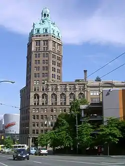 | |
| Swift Canadian Packing House and Office Building | 21 Water Street Vancouver BC |
49°17′02″N 123°06′18″W / 49.2838°N 123.105°W | Vancouver municipality (2523) | 
| |
| Taylor Building | 310 Water Street Vancouver BC |
49°17′03″N 123°06′32″W / 49.2842°N 123.109°W | Vancouver municipality (2549) |  | |
| Taylor Manor | 951 Boundary Road Vancouver BC |
49°16′36″N 123°01′30″W / 49.2767°N 123.025°W | Vancouver municipality (10959) |  | |
| Templeton Building | 9 East Hastings Street Vancouver BC |
49°16′54″N 123°06′14″W / 49.2816°N 123.104°W | Vancouver municipality (8270) | Upload Photo | |
| Templeton Secondary School | 727 Templeton Drive Vancouver BC |
49°16′42″N 123°03′37″W / 49.2783°N 123.0602°W | Vancouver municipality (11309) | ||
| Terminus Hotel | 28-38 Water Street Vancouver BC |
49°17′00″N 123°06′18″W / 49.2834°N 123.105°W | Vancouver municipality (1525) |  | |
| The Barn | 2237 East Pender Street Vancouver BC |
49°16′50″N 123°03′32″W / 49.2805°N 123.059°W | Vancouver municipality (10960) |  | |
| The Homer | 337 Smithe Street Vancouver BC |
49°16′43″N 123°07′05″W / 49.2785°N 123.118°W | Vancouver municipality (11021) |  | |
| The Shirley Houses | 73-91 East 27th Avenue Vancouver BC |
49°14′51″N 123°06′14″W / 49.2475°N 123.104°W | Vancouver municipality (11256) |  | |
| Thompson Rooming House | 110 Water Street Vancouver BC |
49°17′01″N 123°06′25″W / 49.2837°N 123.107°W | Vancouver municipality (2533) |  | |
| Tiedemann Block | 440 West Pender Street Vancouver BC |
49°16′59″N 123°06′47″W / 49.283°N 123.113°W | Vancouver municipality (7941) |  | |
| Town and Robinson Block | 214 Carrall Street Vancouver BC |
49°16′58″N 123°06′14″W / 49.2827°N 123.104°W | Vancouver municipality (2513) |  | |
| Trafalgar Elementary School | 4170 Trafalgar Street Vancouver BC |
49°15′01″N 123°09′50″W / 49.2502°N 123.164°W | Vancouver municipality (10627) | Upload Photo | |
| Tweedale Block | 341 East Hastings Street Vancouver BC |
49°16′54″N 123°05′49″W / 49.2816°N 123.097°W | Vancouver municipality (8510) |  | |
| Twigge Block | 141 Water Street Vancouver BC |
49°17′04″N 123°06′29″W / 49.2844°N 123.108°W | Vancouver municipality (2536) | 
| |
| Union Bank of Canada | 93 West Cordova Street Vancouver BC |
49°16′59″N 123°06′25″W / 49.2831°N 123.107°W | Vancouver municipality (2518) | Upload Photo | |
| Unitarian Church of Vancouver | 949 West 49th Avenue Vancouver BC |
49°13′37″N 123°07′41″W / 49.227°N 123.128°W | Vancouver municipality (8923) | Upload Photo | |
| United Rooms | 139 East Cordova Street Vancouver BC |
49°16′57″N 123°06′04″W / 49.2826°N 123.101°W | Vancouver municipality (7910) | Upload Photo | |
| Vancouver Block | 736 Granville Street Vancouver BC |
49°16′54″N 123°07′08″W / 49.2818°N 123.119°W | Vancouver municipality (10821) |  | |
| Vancouver Board of Parks and Recreation Offices | 2099 Beach Avenue Vancouver BC |
49°17′27″N 123°08′46″W / 49.2909°N 123.146°W | Vancouver municipality (8824) | .jpg.webp) | |
| Vancouver Club | 915 West Hastings Street Vancouver BC |
49°17′13″N 123°06′58″W / 49.287°N 123.116°W | Vancouver municipality (10864) |  | |
| Vancouver Gas Company Warehouse | 135 Keefer Street Vancouver BC |
49°16′47″N 123°06′04″W / 49.2798°N 123.101°W | Vancouver municipality (2049) |  | |
| Vancouver Labour Temple | 411 Dunsmuir Street Vancouver BC |
49°16′55″N 123°06′50″W / 49.282°N 123.114°W | Vancouver municipality (10664) | _411_Dunsmuir_St%252C_Vancouver._2020_Dec_14.jpg.webp) | |
| Vancouver Museum and H.R. MacMillan Space Centre | 1100 Chestnut Street Vancouver BC |
49°16′33″N 123°08′35″W / 49.2757°N 123.143°W | Vancouver municipality (8920) |  | |
| Vancouver Public Safety Building | 312 Main Street Vancouver BC |
49°16′55″N 123°05′56″W / 49.282°N 123.099°W | Vancouver municipality (8782) | Upload Photo | |
| Vancouver Vocational Institute | 250 West Pender Street Vancouver BC |
49°16′53″N 123°06′40″W / 49.2813°N 123.111°W | Vancouver municipality (8924) |  | |
| Vancouver's Chinatown National Historic Site of Canada | Pender Street Vancouver BC |
49°17′09″N 123°07′01″W / 49.2859°N 123.117°W | Federal (18742) |  | |
| Victoria House | 514 Homer Street Vancouver BC |
49°16′57″N 123°06′43″W / 49.2824°N 123.112°W | Vancouver municipality (7933) | _514_Homer_St._Vancouver._2020_Dec_14.jpg.webp) | |
| Victory Square Park | 200 West Hastings Street Vancouver BC |
49°16′56″N 123°06′36″W / 49.2822°N 123.11°W | Vancouver municipality (11191) |  | |
| Villa del Lupo Restaurant | 869 Hamilton Street Vancouver BC |
49°16′42″N 123°07′01″W / 49.2782°N 123.117°W | Vancouver municipality (11160) |  | |
| Vogue Theatre National Historic Site of Canada | 918 Granville Street Vancouver BC |
49°16′48″N 123°07′23″W / 49.2799°N 123.123°W | Federal (5117) | 
| |
| Washington Hotel | 177 East Hastings Street Vancouver BC |
49°16′54″N 123°06′00″W / 49.2817°N 123.1°W | Vancouver municipality (8289) | Upload Photo | |
| Westcoast Transmission Building | 1333 West Georgia Street Vancouver BC |
49°17′20″N 123°07′37″W / 49.289°N 123.127°W | Vancouver municipality (8780) |  | |
| Western Canada Building | 416 West Pender Street Vancouver BC |
49°16′58″N 123°06′47″W / 49.2828°N 123.113°W | Vancouver municipality (7939) |  | |
| William Dick Building | 379 West Hastings Street Vancouver BC |
49°17′01″N 123°06′36″W / 49.2835°N 123.11°W | Vancouver municipality (7930) | Upload Photo | |
| Wing Sang Building | 51 East Pender Street Vancouver BC |
49°16′51″N 123°06′11″W / 49.2807°N 123.103°W | Vancouver municipality (7835) |  | |
| Wright Building | 52 East Hastings Street Vancouver BC |
49°16′52″N 123°06′11″W / 49.2811°N 123.103°W | Vancouver municipality (8282) | Upload Photo | |
| Yale Hotel | 1300 Granville Street Vancouver BC |
49°16′33″N 123°07′40″W / 49.2758947°N 123.1277732°W | Vancouver municipality (10823) |  | |
| Yue Shan Society Buildings | 33 East Pender Street Vancouver BC |
49°16′51″N 123°06′11″W / 49.2807°N 123.103°W | Vancouver municipality (11192) |  |
Template:Navbox
This article is issued from Wikipedia. The text is licensed under Creative Commons - Attribution - Sharealike. Additional terms may apply for the media files.